
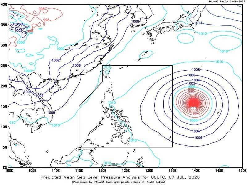
Tropical cyclone wind signals may be raised over the northern and eastern portions of Northern Luzon as early as Tuesday night or Wednesday morning as Super Typhoon Bavi approaches the Philippine Area of Responsibility (PAR), state weather bureau PAGASA said.
In its advisory issued late Monday morning, PAGASA said the super typhoon remains outside PAR but continues to be closely monitored due to its strength and potential impacts.
As of 3:00 a.m., Tuesday, July 7, Bavi was located approximately 2,010 kilometers east of Central Luzon. The cyclone was packing maximum sustained winds of 195 kilometers per hour near the center, with gusts reaching 240 kph, while moving west-northwest at 30 kph.
PAGASA said Bavi is expected to enter the PAR by Tuesday night or Wednesday morning.
While the possibility of landfall remains less likely, the weather bureau noted that the typhoon could make a close approach to the Batanes Islands. Because of its large circulation and strong winds, tropical cyclone wind signals may be hoisted over parts of Northern Luzon once the system enters PAR.
Despite the low chance of landfall, Bavi is expected to enhance the southwest monsoon, or habagat, bringing widespread rains over several areas of the country.
"Less likely naman yung landfall scenario gayunpaman ang close approach nito sa Isla ng Batanes. Kaya asahan na ang pagtaas ng tropical cyclone wind signal as early as Tuesday night, Wednesday morning," PAGASA's Veronica Torres.
For Tuesday, cloudy skies with scattered rains and thunderstorms are expected over the Zamboanga Peninsula, the Bangsamoro Autonomous Region in Muslim Mindanao (BARMM), Lanao del Sur, Lanao del Norte, and Sultan Kudarat due to the enhanced southwest monsoon.
Meanwhile, Metro Manila is expected to experience generally fair weather, with isolated rain showers or thunderstorms caused by localized weather conditions.
PAGASA also said more areas across the country may experience the effects of the enhanced southwest monsoon in the coming days as Bavi moves closer to the Philippines.
No gale warning has been raised over the country's coastal waters as of Monday. However, PAGASA warned that a gale warning may be issued in the coming days as the super typhoon continues to approach the country's area of responsibility.
