
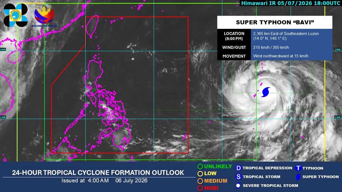
Super Typhoon Bavi is expected to enter the Philippine Area of Responsibility (PAR) by Tuesday evening, July 7, or early Wednesday, July 8, according to the Philippine Atmospheric, Geophysical and Astronomical Services Administration (PAGASA).
As of 2:00 a.m. Monday, July 6, PAGASA said Bavi was being monitored outside the PAR with maximum sustained winds of 215 kilometers per hour (kph) and gusts of up to 265 kph.
Bavi was located 2,355 kilometers east of Southern Luzon.
It is moving west northwestward at 15 km/h.
"Possible itong pumasok ng PAR tomorrow evening o Wednesday ng madaling araw," PAGASA weather specialist Chenel Dominguez said in an interview with DZRH News.
Once inside the PAR, the cyclone will be given the local name "Inday."
Despite its strength, Dominguez said the super typhoon has a low chance of making landfall in the Philippines. However, it may make a close approach to Batanes while a possible landfall in Taiwan remains under consideration based on its current forecast track.
PAGASA also said tropical cyclone wind signals may be raised over parts of Northern Luzon as early as Tuesday night or Wednesday morning, depending on the typhoon's movement.
Meanwhile, a gale warning may also be issued over the country's eastern seaboard due to the typhoon's intensity.
The weather bureau added that Bavi is expected to enhance the southwest monsoon or habagat, which could bring widespread rains over the western sections of the country even if the cyclone remains offshore.
For the rest of the country on Monday, July 6, PAGASA said generally fair weather will prevail, although hot and humid conditions are expected, especially from late morning to afternoon. Isolated rain showers and thunderstorms triggered by localized convection remain likely in the afternoon and evening.
