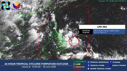
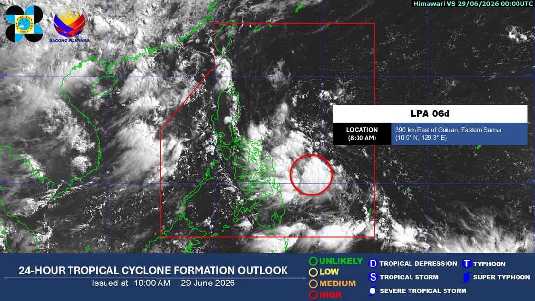
The low pressure area (LPA) being monitored inside the Philippine Area of Responsibility (PAR) now has a high chance of developing into a tropical depression within the next 24 hours, the state weather bureau said on Monday.
In its 8 a.m. weather advisory, the Philippine Atmospheric, Geophysical and Astronomical Services Administration (PAGASA) said the LPA was last spotted 390 kilometers east of Guiuan, Eastern Samar.
"As of 8:00 AM today, 29 June 2026, the Low Pressure Area (LPA 06d) is being monitored inside the Philippine Area of Responsibility (PAR) and now has a 'HIGH' chance of developing into a tropical depression within the next 24 hours," PAGASA said.
The weather bureau advised the public to continue monitoring its latest bulletins and advisories as the weather disturbance develops.
Earlier, PAGASA said the LPA is expected to bring cloudy skies with scattered rains and thunderstorms over parts of the Visayas, Bicol Region, Caraga, Quezon, Oriental Mindoro, Marinduque, and Romblon.
Residents in areas that may be affected by moderate to heavy rainfall were urged to remain vigilant for possible flooding and landslides.