
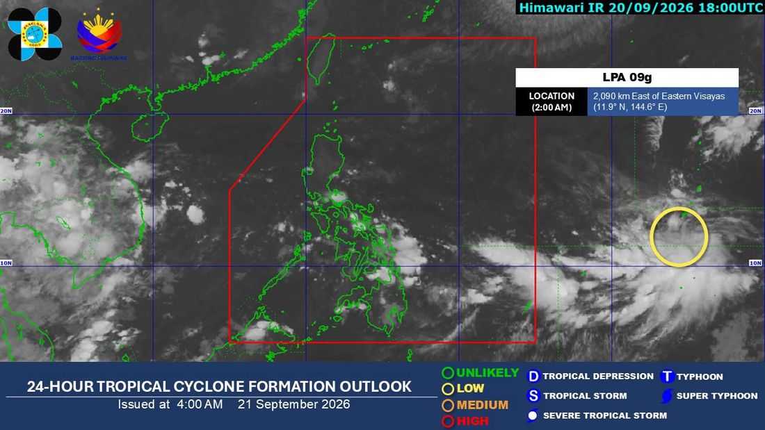
The southwest monsoon, or Habagat, will continue to bring isolated rains over the western section of Southern Luzon, while a low-pressure area (LPA) east of the Visayas is being monitored and may enter the Philippine Area of Responsibility (PAR) by Tuesday or Wednesday.
In its 5 a.m. weather bulletin, the Philippine Atmospheric, Geophysical and Astronomical Services Administration (PAGASA) said Monday that the LPA, which formed at around 2 a.m., was located more than 2,000 kilometers east of the Visayas.
It may enter PAR by Tuesday or Wednesday and could develop into a tropical depression by Thursday, September 24, or Friday, September 25, according to weather specialist, Aldczar Aurelio.
Once inside PAR, the weather disturbance will be given the local name “Queenie.”
As of Monday, the LPA has yet to directly affect the country’s weather.
Meanwhile, the weak Habagat will continue to affect the western section of Southern Luzon over the next three days, bringing a chance of isolated rains.
"Base sa ating mga data, patuloy din ang makakapekto ang mahinang habagat sa western section ng southern Luzon sa susunod na tatlong araw," Aurelio said.
Generally fair and sunny weather is expected over Luzon, as well as in the Visayas and Mindanao, although isolated rain showers and sudden downpours may still occur due to localized thunderstorms.
The weather bureau also said there is no gale warning in effect Monday, meaning no dangerous sea conditions or unusually high waves are expected in Philippine coastal waters.
