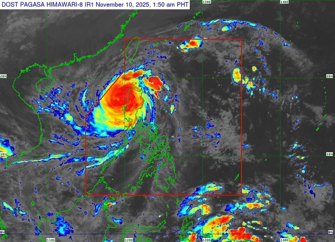
Uwan has weakened into a typhoon after passing Northern and Southern Luzon, according to Philippine Atmospheric, Geophysical and Astronomical Services Administration (PAGASA) on Monday, November 10.
As of 1:00 AM, the storm’s eye was located near Bagulin, La Union. It has maximum sustained winds of 165 km/h, gusts up to 275 km/h, and a central pressure of 945 hPa. It is moving northwest at 30 km/h.
Tropical Cyclone Wind Signals remain in effect in affected areas.
It is expected to move over the coastal waters of La Union this morning, November 10.
Once it reaches the West Philippine Sea, the typhoon is projected to maintain its current strength until November 11 before gradually weakening due to less favorable atmospheric conditions.
Uwan will track northwestward to northward between today and tomorrow while remaining within the typhoon category.
On Wednesday, November 12, it is expected to turn northeastward toward the Taiwan Strait as it begins to weaken. It is likely to make landfall over western Taiwan by Thursday, November 13, where it is predicted to rapidly lose strength as it crosses the landmass.
Afterward, Uwan may emerge over the waters near the Ryukyu Islands, weakening further into a remnant low.