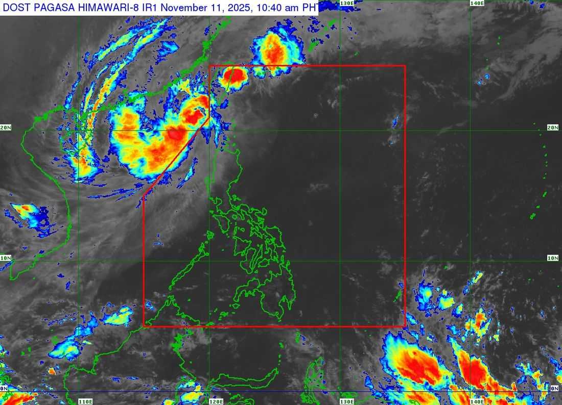
Typhoon Uwan has weakened into a severe tropical storm while remaining outside the Philippine Area of Responsibility (PAR), according to the latest advisory from PAGASA issued Tuesday morning.
As of 10:00 a.m., the center of Severe Tropical Storm Uwan was located 370 kilometers west-northwest of Calayan, Cagayan (19.9°N, 118.0°E). It is moving north-northwest at 10 km/h, with maximum sustained winds of 110 km/h near the center and gusts of up to 135 km/h.
Despite being outside PAR, Uwan continues to enhance winds and sea conditions over Northern and Central Luzon. PAGASA said strong to storm-force winds extend outward up to 550 kilometers from the storm’s center.
Tropical Cyclone Wind Signals remains in the following areas:
Signal No. 2
- Batanes
- the western portion of Ilocos Norte: Sarrat, Paoay, Bangui, Burgos, Bacarra, Currimao, Pasuquin, San Nicolas, Laoag City
Signal No. 1
- The northern and central portions of Cagayan: Piat, Santo Niño, Camalaniugan, Tuao, Lal-Lo, Pamplona, Gonzaga, Alcala, Amulung, Santa Teresita, Buguey, Solana, Rizal, Santa Ana, Claveria, Gattaran, Iguig, Lasam, Aparri, Ballesteros, Abulug, Allacapan, Sanchez-Mira, Santa Praxedes, Baggao
- Babuyan Islands
- Apayao
- Abra
- Kalinga
- the western portion of Mountain Province: Besao, Tadian, Sagada, Bauko, Sadanga, Bontoc, Sabangan
- the northwestern portion of Benguet: Bakun, Kibungan, Kapangan, Mankayan
- the rest of Ilocos Norte
- Ilocos Sur
- the northern and central portions of La Union: Luna, Caba, Santol, Bauang, City of San Fernando, San Juan, Bagulin, Bangar, San Gabriel, Burgos, Naguilian, Bacnotan, Sudipen, Balaoan
- the western portion of Pangasinan: Bani, Bolinao, Anda, Agno
PAGASA warned that Uwan will continue to bring occasionally gusty conditions, especially in coastal and upland areas across Luzon and parts of Visayas. A Gale Warning is also in effect for the seaboards of Northern Luzon and the western coasts of Central and Southern Luzon, with waves reaching up to 8 meters in some areas.
Sea travel is considered risky for all types of vessels, and mariners are advised to remain in port or seek shelter until conditions improve.
Uwan is expected to maintain a recurving path — turning northward today, then northeastward by Tuesday night, before shifting eastward later in the week.
PAGASA said it may re-enter PAR on Wednesday evening as it approaches the southwestern coast of Taiwan before emerging near the Ryukyu Islands. It is forecast to weaken further and possibly dissipate into a remnant low by Friday, November 14.
Authorities have urged residents in high-risk areas to remain alert and follow evacuation and safety instructions from local officials.