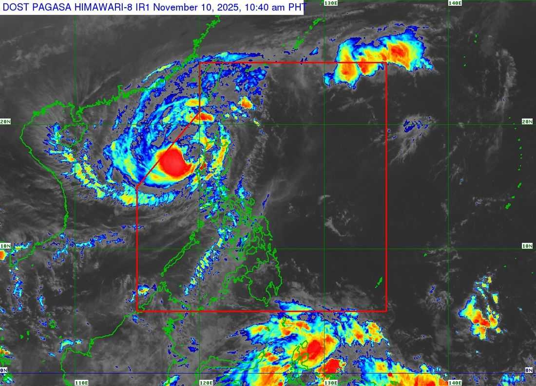
Typhoon Uwan has continued to weaken as it moves farther over the West Philippine Sea, according to the latest advisory issued by the Philippine Atmospheric, Geophysical and Astronomical Services Administration (PAGASA).
As of 10:00 a.m., the center of Typhoon Uwan was estimated based on all available data at 135 kilometers west northwest of Bacnotan, La Union.
The typhoon now carries maximum sustained winds of 130 kp/h near the center, gustiness of up to 160 kp/h. It is moving west northwestward at a speed of 20 kp/h.
Tropical Cyclone Wind Signals (TCWS) in effect:
TCWS No. 3
Luzon
- Ilocos Sur
- Northern and central portions of La Union: Luna, Caba, Santol, Bauang, City of San Fernando, San Juan, Bagulin, Aringay, Bangar, San Gabriel, Burgos, Naguilian, Agoo, Bacnotan, Sudipen, Balaoan
- Northwestern portion of Pangasinan (Bolinao, Bani, Agno, City of Alaminos, Anda)
TCWS No. 2
Luzon
- Batanes
- Cagayan
- Babuyan Islands
- Isabela
- Quirino
- Nueva Vizcaya
- Apayao
- Abra
- Kalinga
- Mountain Province
- Ifugao
- Benguet
- Ilocos Norte
- La Union
- Pangasinan
- Aurora
- Zambales
- Bataan
- Nueva Ecija
- Tarlac
- Pampanga
- Bulacan
TCWS No. 1
Luzon
- Metro Manila
- Cavite
- Laguna
- Batangas
- Rizal
- Quezon
- Polillo Islands
- Oriental Mindoro
- Occidental Mindoro
- Lubang Island
- Marinduque
- Romblon
- Northern portion of Palawan (Taytay, Dumaran, El Nido, Araceli) including Calamian and Cuyo Islands
- Camarines Norte
- Camarines Sur
- Catanduanes
- Albay
- Sorsogon
- Northern and western portions of Masbate (City of Masbate, Mobo, Aroroy, Balud, Mandaon, Milagros, Baleno)
- Burias and Ticao Islands
Visayas
- Aklan, Capiz
- Northern and central portions of Antique (Pandan, Libertad, Sebaste, Culasi, Tibiao, Barbaza, Bugasong, Laua-an)
- Caluya Islands
Heavy rainfall, severe winds, and storm surges may still affect areas far from its center
Uwan is expected to follow a recurving path, turning northwestward today, then moving northward by Monday, November 11, and northeastward in the succeeding days. A brief re-intensification is possible as the system moves over the waters southwest of Taiwan, although gradual weakening is anticipated starting Tuesday, November 12.
"UWAN is forecast to exit PAR tonight or tomorrow early morning," said the state weather bureau.
However, PAGASA reported that it could re-enter PAR by Wednesday evening as it approaches and makes landfall along the southwestern coast of Taiwan, where it is likely to weaken further.
On Thursday, November 13, the system is expected to move toward the waters near the Ryukyu Islands, before dissipating into a remnant low by Friday, November 14.