Typhoon Tino continues to batter parts of the Visayas early Tuesday as it approaches Cebu, bringing life-threatening winds and storm surge, according to the state weather bureau PAGASA.
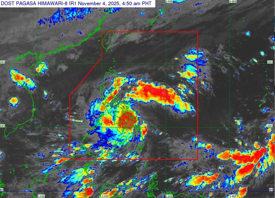
As of 4:00 a.m., the eye of Typhoon Tino was located over the coastal waters of San Francisco, Cebu, based on data from Masbate and Mactan Doppler radars. The typhoon packs maximum sustained winds of 150 km/h near the center, gusts of up to 205 km/h, and a central pressure of 960 hPa. It is moving westward at 25 km/h.
Strong to typhoon-force winds extend outward up to 300 kilometers from the center.
Areas Under Tropical Cyclone Wind Signals
TCWS No. 4 (Typhoon-force winds – 12 hours lead time)
Visayas:
-
Northern and Central Cebu including Cebu City, Mandaue, Lapu-Lapu, Cordova
-
Camotes Islands, Bantayan Islands
-
Western and southern Leyte including Baybay City, Hilongos, Bato, Abuyog, Dulag, Burauen, etc.
-
Northeastern Bohol including Ubay, Talibon, Getafe
-
Northern Negros Oriental (Vallehermoso, Canlaon City)
-
Northern Negros Occidental including Bacolod City, Silay, Talisay, Cadiz, Sagay, Bago, etc.
-
Guimaras
-
Central and southern Iloilo including Iloilo City, Pavia, Oton, Cabatuan, Miagao, Passi City, etc.
-
Southern Antique including San Jose, Sibalom, Tobias Fornier, Anini-y
TCWS No. 3 (Storm-force winds – 18 hours lead time)
Luzon:
-
Cuyo Islands
Visayas:
-
Southern Leyte
-
Central and eastern Bohol including Carmen, Jagna, Inabanga, Duero
-
Northern Negros Oriental (Guihulngan City, La Libertad, Jimalalud)
-
Central Negros Occidental (Hinigaran, Isabela, Kabankalan)
-
Southern Capiz including Tapaz, Mambusao, Pilar
-
Central Antique including Barbaza, Tibiao, Laua-An
TCWS No. 2 (Gale-force winds – 24 hours lead time)
Luzon:
-
Southern Masbate, Southern Romblon, parts of Mindoro, northern Palawan including Calamian Islands
Visayas:
-
Eastern Samar including Borongan, Guiuan
-
Samar and Biliran
-
Remaining areas of Leyte and Bohol
-
Remaining Cebu
-
Central Negros Oriental including Dumaguete, Bais, Tanjay
-
Remaining Negros Occidental
-
Aklan, remaining Capiz and Antique
Mindanao:
-
Dinagat Islands, Surigao del Norte, Siargao, Camiguin
TCWS No. 1 (Strong winds – 36 hours lead time)
Luzon:
-
Bicol Region including Albay, Sorsogon, remaining Romblon, Masbate, Quezon, Marinduque
-
Central Palawan including Puerto Princesa
Visayas:
-
Northern Samar, remaining Eastern Samar and Samar
-
Remaining Negros Oriental
Mindanao:
-
Northern Caraga, Agusan del Norte, northern Bukidnon, Misamis Oriental, Misamis Occidental, northern Zamboanga del Norte
Storm Surge, Rough Seas Expected
Storm surge exceeding 3 meters may impact low-lying coastal communities in Western and Central Visayas, Eastern Visayas, Mimaropa, Palawan, Northern Mindanao, and nearby island provinces. Sea travel is suspended due to waves reaching up to 7 meters.
Typhoon Tino passed near Camotes Islands and will cross Visayas and northern Palawan before exiting the Philippine Area of Responsibility by Wednesday night or early Thursday. It may weaken slightly due to terrain interaction but will remain a typhoon.
Residents in high-risk areas are urged to evacuate and follow local government advisories.
Disaster officials warn of widespread floods, landslides, power interruptions, and impassable roads due to fallen trees and debris.