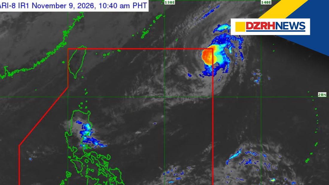
Typhoon Samuel (international name: Cempaka) has entered the Philippine Area of Responsibility (PAR) and was given the local name Samuel, according to the Philippine Atmospheric, Geophysical and Astronomical Services Administration (PAGASA) on Monday, November 9.
In its 11 a.m. tropical cyclone bulletin, PAGASA estimated the center of Samuel at 1,370 kilometers east-northeast of Extreme Northern Luzon as of 10 a.m.
The typhoon was packing maximum sustained winds of 120 kilometers per hour (km/h) near the center, gusts of up to 150 km/h, and a central pressure of 980 hectopascals. It was moving north-northwestward at 20 km/h, with strong to typhoon-force winds extending up to 300 kilometers from its center.
PAGASA said no Tropical Cyclone Wind Signal (TCWS) has been raised over any part of the country, as Samuel is unlikely to directly affect Philippine weather conditions throughout the forecast period.
However, the agency warned that the Northeast Monsoon or Amihan may bring strong to gale-force wind gusts over most of Luzon and Visayas, as well as parts of Mindanao, from Monday through Wednesday, November 11.
Meanwhile, very rough to rough sea conditions are expected over several coastal areas, particularly in Northern Luzon.
Wave heights may reach up to 5.5 meters along the northern seaboard of Batanes, 5 meters over parts of the Babuyan Islands, and 4.5 meters along the northern seaboard of Ilocos Norte and northeastern mainland Cagayan.
PAGASA warned that sea travel would be dangerous for all types of vessels in areas experiencing very rough seas, advising mariners to remain in port or seek safe shelter until conditions improve. Operators of small seacrafts, including motorbancas, were also advised against venturing out to sea in areas with rough waters.
For its track outlook, Samuel is forecast to turn slowly north-northeastward within the next 12 hours and exit the PAR between Monday evening and early Tuesday morning, November 10.
The typhoon is also expected to continue intensifying and may reach its peak strength by Monday evening or early Tuesday before weakening due to unfavorable environmental conditions.
Despite the absence of wind signals, PAGASA urged the public and disaster risk reduction offices to remain vigilant and take necessary precautions to protect lives and property.
The agency also reminded residents to monitor weather advisories and warnings issued by their respective PAGASA Regional Services Divisions.
The next tropical cyclone bulletin is scheduled for release at 5 p.m. Monday.