
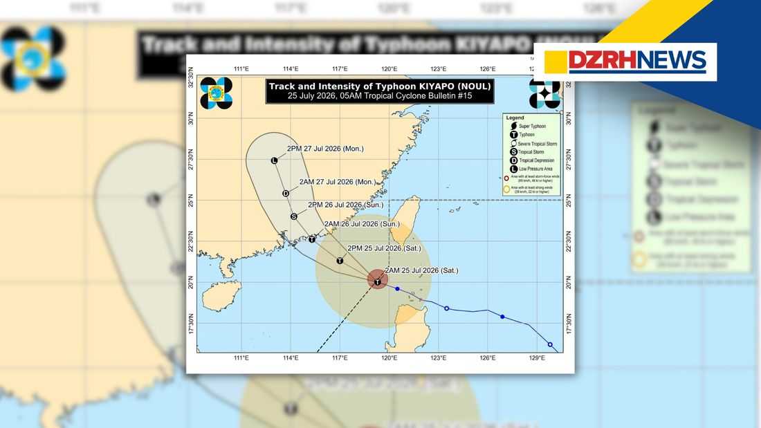
Kiyapo (international name: Noul) has rapidly intensified into a typhoon after exiting the Philippine Area of Responsibility (PAR), but Tropical Cyclone Wind Signal (TCWS) No. 1 remains in effect over several areas in Northern Luzon due to its wide circulation, according to the latest bulletin issued by PAGASA at 5:00 a.m. on Saturday, July 25.
As of 4:00 a.m., the center of Typhoon Kiyapo was located approximately 320 kilometers west of Basco, Batanes, packing maximum sustained winds of 120 km/h, gusts of up to 150 km/h, and a central pressure of 975 hPa. The typhoon was moving west-northwestward at 25 km/h, with strong to typhoon-force winds extending up to 470 kilometers from its center.
PAGASA maintained TCWS No. 1 over Batanes, the western portion of the Babuyan Islands, the northwestern part of mainland Cagayan, the northern portion of Apayao, and Ilocos Norte, warning of strong winds ranging from 39 to 61 km/h that may pose minimal to minor threats to life and property.
Although Kiyapo has already left PAR, PAGASA warned that the typhoon, together with the Southwest Monsoon (Habagat), will continue to bring strong to gale-force winds across most of Luzon, Western Visayas, the Negros Island Region, Northern Samar, Zamboanga del Norte, and Davao Oriental.
The weather bureau also cautioned residents to monitor heavy rainfall advisories, as Kiyapo and the enhanced southwest monsoon could trigger flooding and rain-induced landslides in vulnerable areas.
Meanwhile, a gale warning remains in effect over the northern seaboard of Northern Luzon. PAGASA warned of very rough seas of up to 4.5 meters along the seaboards of Batanes, the Babuyan Islands, and the northern coast of Ilocos Norte, making sea travel dangerous for all types of vessels. Mariners were advised to remain in port or seek safe harbor until conditions improve.
PAGASA forecasts that Kiyapo will continue moving northwestward toward southern mainland China, where it is expected to make landfall within the next 12 hours. While the cyclone may strengthen further before landfall, it is expected to weaken rapidly as it moves inland.
The weather bureau urged the public and local disaster risk reduction and management offices to remain vigilant, follow official advisories, and take necessary precautions to protect lives and property.
