
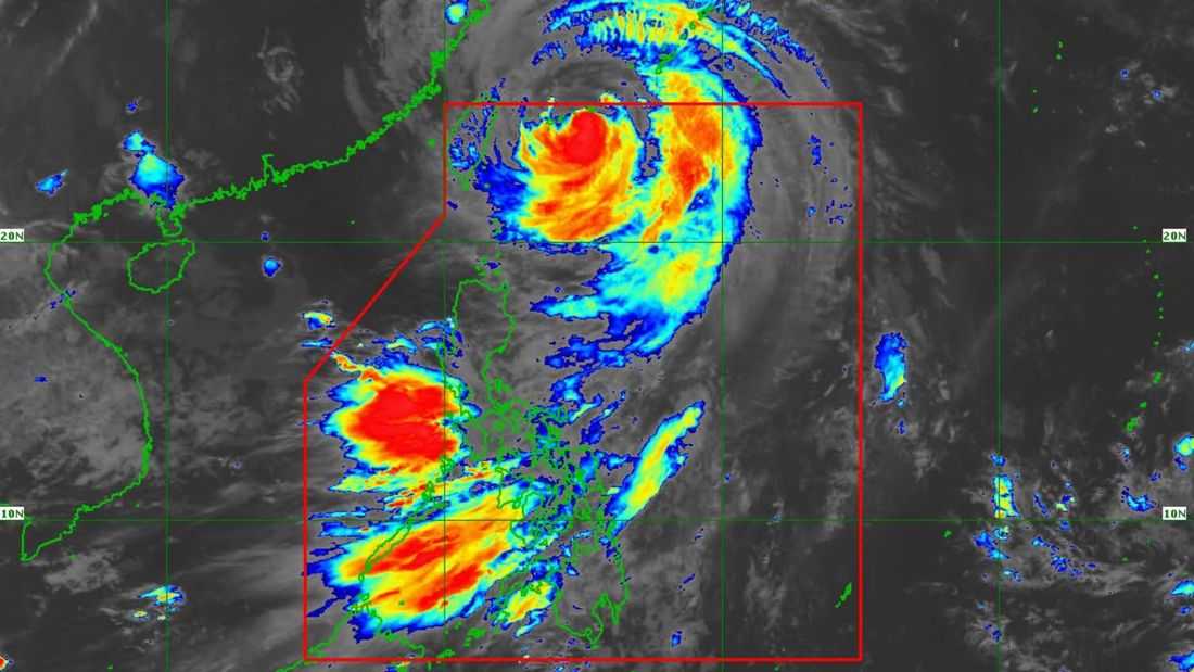
Typhoon Inday is on track to exit the Philippine Area of Responsibility (PAR) Saturday morning as it continues moving northwestward toward southern Japan, the Philippine Atmospheric, Geophysical and Astronomical Services Administration (PAGASA) said.
According to the state weather bureau, the storm is forecast to either make landfall or pass close to the Sakishima Islands before leaving PAR. Afterward, Inday will traverse the East China Sea and is expected to make landfall along the eastern coast of mainland China.
The typhoon is projected to maintain its strength over the next 12 hours, but will likely weaken into a severe tropical storm once it moves farther inland over China.
Despite its gradual exit, Inday may still influence weather conditions in parts of the Philippines. Its outer circulation, combined with the southwest monsoon, is expected to bring gusty winds and rough seas, particularly over northern Luzon and coastal areas.
Authorities continue to advise vigilance, especially for communities in areas still experiencing strong winds and hazardous sea conditions.
