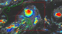
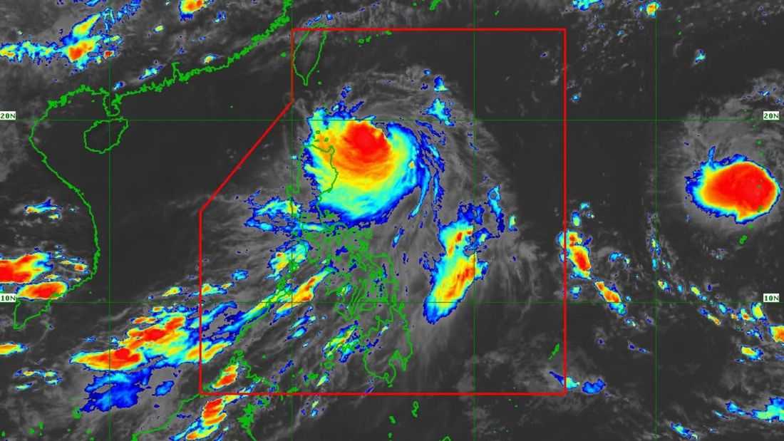
Typhoon Francisco is forecast to exit the Philippine Area of Responsibility (PAR) on Thursday evening (June 25 ) or Friday morning (June 26), the PAGASA said.
As of 5:00 PM on Tuesday, June 23, the state weather bureau announced that Francisco maintains its strength while moving northwestward over the Philippine Sea. It was located at 330 km east of Calayan, Cagayan.
It has maximum sustained winds of 175 km/h near the center, gustiness of up to 215 km/h and central pressure of 940 hPa.
It is currently moving northwestward at 10 km/h.
Tropical Cyclone Wind Signal (TCWS) No. 1 is currently hoisted in the following areas:
- Batanes
- The northeastern portion of Cagayan (Gonzaga, Santa Ana)
- The eastern portion of Babuyan Islands (Babuyan Is., Didicas Is., Camiguin Is.,)
The typhoon is forecast to move northward on Tuesday evening until Wednesday, June 24, before recurving generally northeastward from that day onwards towards the Ryukyu Islands and sea south of mainland Japan.
On the forecast track, Francisco will maintain its strength in the near term, but is expected to gradually weaken throughout the forecast period. According to PAGASA, it will remain a typhoon while inside the PAR region.