
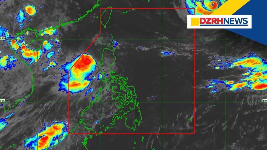
Tropical Storm Maymay continued to move northward over the waters west of La Union and is expected to shift eastward, with a possible landfall over Ilocos Sur or La Union by Wednesday night or early Thursday morning, according to the Philippine Atmospheric, Geophysical and Astronomical Services Administration (PAGASA).
In its 11 a.m. Weather Advisory issued on Wednesday, August 5, PAGASA said the center of Maymay was last located 185 kilometers west-northwest of Bacnotan, La Union.
The weather bureau said Maymay is forecast to continue moving eastward toward Northern Luzon, bringing heavy rainfall over several areas due to the cyclone and the enhanced Southwest Monsoon.
PAGASA warned of heavy rainfall of more than 200 millimeters from Wednesday to Thursday noon in La Union and Benguet.
Rainfall amounts between 100 to 200 millimeters are expected in Ilocos Sur, Pangasinan, Abra, and Zambales, while 50 to 100 millimeters of rainfall may affect Ilocos Norte, Apayao, Kalinga, Mountain Province, Ifugao, Nueva Vizcaya, Tarlac, Nueva Ecija, Bataan, Pampanga, and Bulacan.
From Thursday noon to Friday noon, Ilocos Sur, La Union, Pangasinan, and Benguet may still experience rainfall amounts of 50 to 100 millimeters.
Meanwhile, the Southwest Monsoon or habagat is also expected to bring moderate to heavy rains over parts of Luzon, including Metro Manila, Rizal, Cavite, Batangas, and Occidental Mindoro.
PAGASA said Occidental Mindoro may experience heavy to intense rainfall from Thursday noon to Friday noon, with Zambales, Bataan, Cavite, Batangas, and Antique also affected by moderate to heavy rains.
The weather bureau further warned that rainfall forecasts may be higher in mountainous and elevated areas, with impacts potentially worsened by significant antecedent rainfall.
PAGASA advised concerned disaster risk reduction and management offices to take necessary measures to protect lives and property.
The agency said its regional offices may issue Heavy Rainfall Warnings, Thunderstorm Advisories, and other localized weather information as needed. The next Weather Advisory for Tropical Cyclone Maymay and the Southwest Monsoon is scheduled for 5 p.m. Wednesday.
