
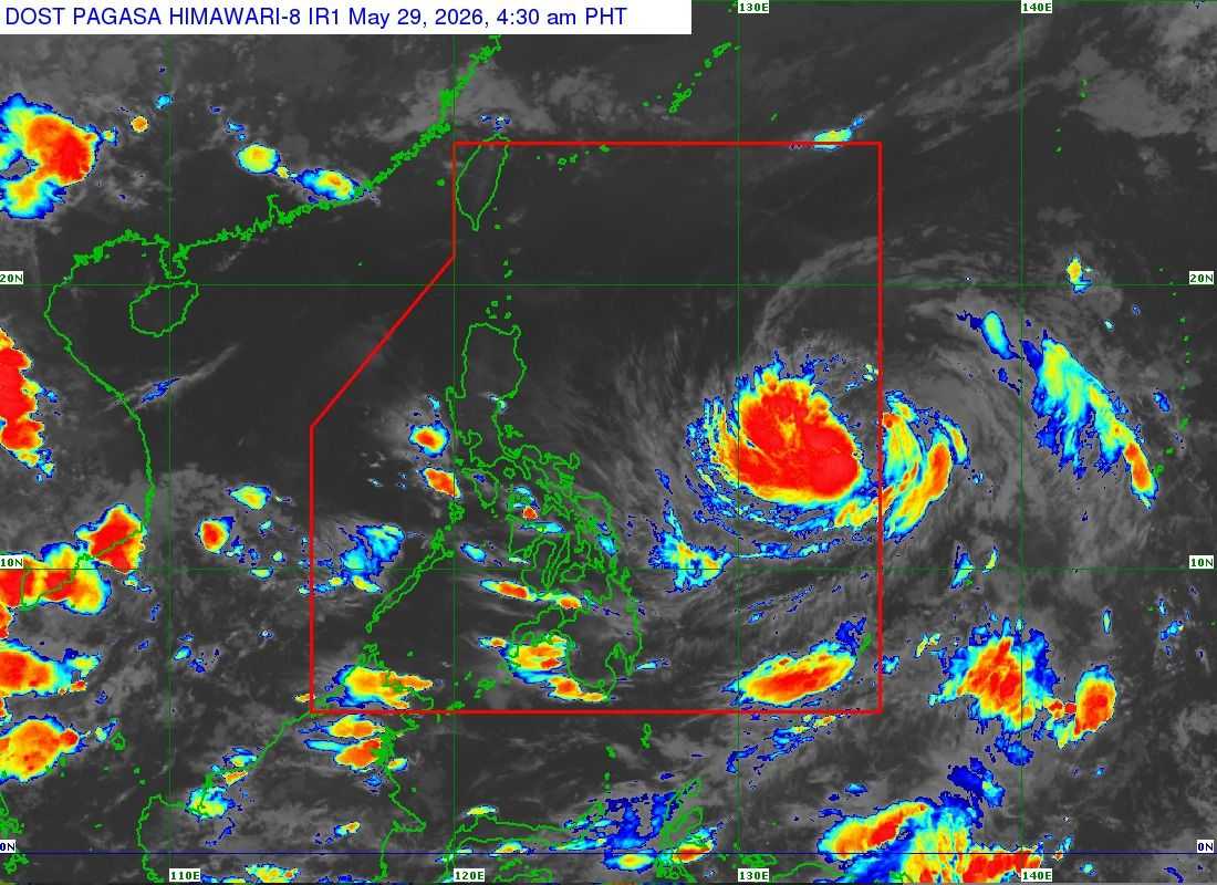
Tropical Storm “Domeng” has entered the Philippine Area of Responsibility (PAR), according to DOST-PAGASA on Friday morning, May 29.
In its 5:00 a.m. bulletin, PAGASA said the center of Domeng was estimated at 1,345 kilometers east of Southeastern Luzon, carrying maximum sustained winds of 75 kilometers per hour near the center and gusts of up to 90 kph.
The tropical storm was moving northwestward at 20 kph.
Despite entering PAR, PAGASA said no Tropical Cyclone Wind Signal (TCWS) has been raised as of posting time.
However, the state weather bureau warned that the enhanced southwesterly windflow or “habagat” caused by Domeng may bring heavy rains over the western portions of the country beginning Sunday, May 31.
PAGASA added that a weather advisory may be issued on Saturday in anticipation of possible heavy rainfall.
Meanwhile, strong to gale-force gusts are expected to affect several parts of the country starting Saturday, including most of the Visayas, Batanes, Cagayan, Pangasinan, Zambales, Bataan, Cavite, Batangas, Mindoro provinces, Romblon, Marinduque, Masbate, Albay, Sorsogon, Palawan, and parts of Mindanao.
The same weather conditions are expected to continue on Sunday over most of Visayas, CALABARZON, MIMAROPA, Bicol Region, and several provinces in Northern and Southern Mindanao.
PAGASA said the hoisting of tropical cyclone wind signals over Extreme Northern Luzon remains less likely, but is not yet ruled out.
Authorities continue to monitor the movement of Tropical Storm Domeng as it traverses the Philippine Sea.
