
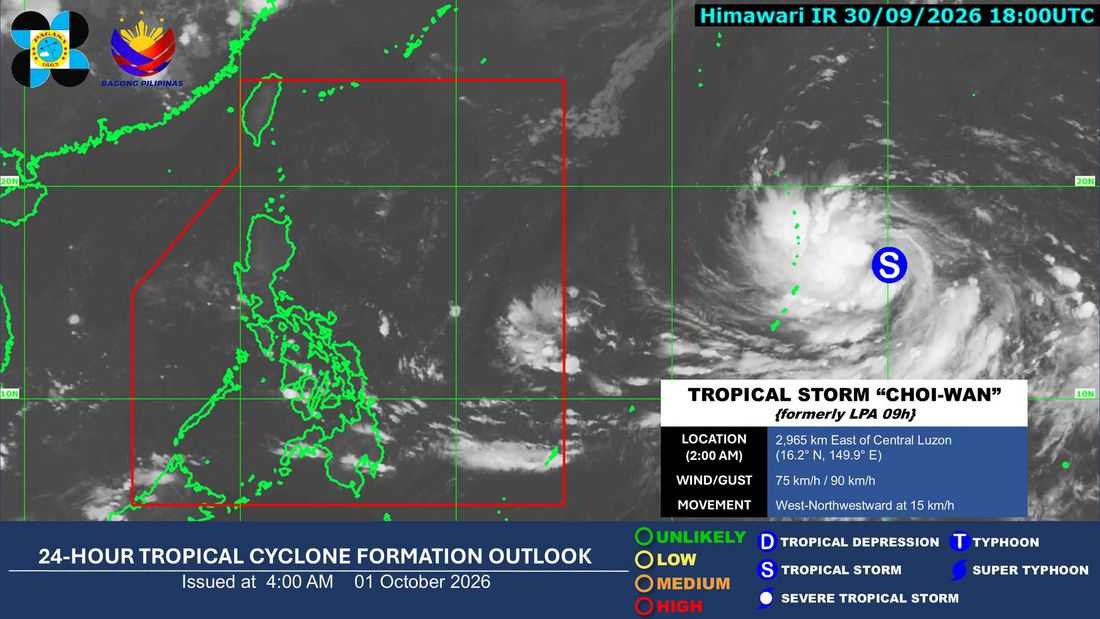
The trough of Tropical Storm “Choi-Wan” will bring cloudy skies, scattered rains and thunderstorms over parts of the Visayas and Mindanao on Thursday, October 1, according PAGASA.
PAGASA said Eastern Visayas, Caraga, and Davao Oriental may experience cloudy skies with scattered rains and thunderstorms due to the trough of Choi-Wan.
Northern Mindanao and the rest of Davao Region, meanwhile, will have partly cloudy to cloudy skies with isolated rainshowers or thunderstorms.
Metro Manila and the rest of the country are also expected to experience partly cloudy to cloudy skies with isolated rainshowers or thunderstorms, which may be caused by localized thunderstorms.
As of 3 a.m. Thursday, Tropical Storm Choi-Wan was located 2,945 kilometers east of Central Luzon, with maximum sustained winds of 75 kilometers per hour near the center and gustiness of up to 90 kph.
The storm was moving west-northwestward at 15 kph and remained outside the Philippine Area of Responsibility (PAR).
PAGASA continues to monitor the tropical cyclone and its possible effects on weather conditions in the country.
