
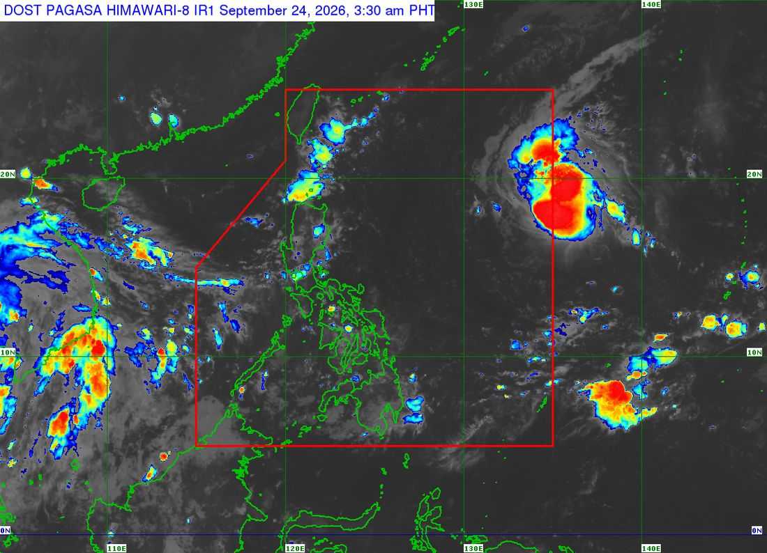
In its 5 a.m. weather forecast, PAGASA weather specialist Obet Badrina said Surigae was last located around 1,500 kilometers east of Northern Luzon, packing maximum sustained winds of 75 kilometers per hour near the center and gustiness of up to 90 kph.
The storm was moving west-northwestward at 30 kph and was expected to enter PAR Thursday morning, after which it will be locally named Queenie.
PAGASA said Surigae's trough, or extension, was already affecting parts of the country, bringing cloudy skies and scattered rains over Eastern Visayas and Caraga.
The weather bureau said the storm is not expected to make landfall over the Philippine landmass and is unlikely to significantly enhance the southwest monsoon or Habagat.
Based on its latest forecast track, Surigae is expected to continue moving west-northwestward toward the southern part of Japan and the Ryukyu Islands through Monday.
PAGASA said most parts of Luzon, including Metro Manila, will generally experience fair weather, although localized rain showers and thunderstorms may occur, particularly in the afternoon and evening.
Palawan may also experience localized rain showers and thunderstorms.
In the Visayas, cloudy skies with scattered rain showers and thunderstorms are expected over Biliran, Southern Leyte and Leyte, while the rest of the region may experience localized rain showers and thunderstorms.
In Mindanao, cloudy skies and scattered rains may affect parts of Caraga, particularly Dinagat Islands, Surigao del Norte and Surigao del Sur. The rest of Mindanao may experience localized rain showers and thunderstorms.
The weather bureau also said there are currently no other low-pressure areas being monitored inside PAR.
PAGASA said no gale warning is currently in effect over any part of the country.
Sea conditions are expected to be slight to moderate, but small boats and other small sea vessels are advised to exercise caution, particularly during localized thunderstorms, which may cause sudden increases in wave heights.
