
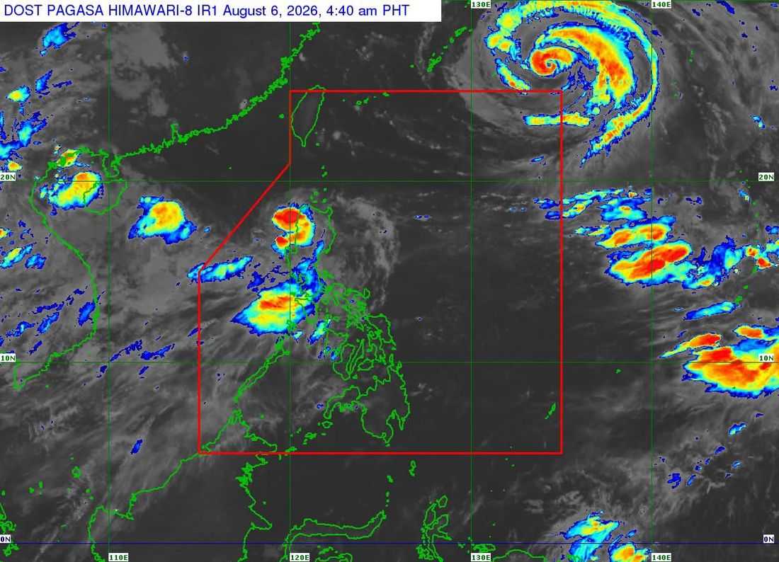
Tropical Storm Maymay made landfall in Magsingal, Ilocos Sur, at 2 a.m. on Thursday, August 6, as it continued to move across Northern Luzon, the state weather bureau said.
In its 5 a.m. bulletin, the Philippine Atmospheric, Geophysical and Astronomical Services Administration (PAGASA) said Maymay was last located in the vicinity of San Juan, Ilocos Sur.
The cyclone was packing maximum sustained winds of 65 kilometers per hour (kph) near the center, gustiness of up to 110 kph, and was moving eastward at 10 kph.
Following this, Tropical Cyclone Wind Signal (TCWS) are in effect:
TCWS No. 2
- Ilocos Norte
- The northern and central portions of Ilocos Sur (Gregorio del Pilar, Magsingal, San Esteban, Banayoyo, Cervantes, Burgos, City of Candon, Santa Lucia, Santiago, San Vicente, Santa Catalina, Lidlidda, Nagbukel, Sinait, Suyo, Sigay, San Ildefonso, Galimuyod, Quirino, City of Vigan, San Emilio, Cabugao, Caoayan, San Juan, Santa, Bantay, Santo Domingo, Tagudin, Santa Cruz, Santa Maria, Narvacan, Salcedo)
- The western portion of Apayao (Conner, Kabugao, Calanasan)
- Abra
- The western portion of Kalinga (Pasil, Tinglayan, Balbalan, Lubuagan)
- The western portion of Mountain Province (Besao, Tadian, Bauko, Sagada, Sabangan, Bontoc, Sadanga)
TCWS No. 1
- The rest of Ilocos Sur
- La Union
- The northern portion of Pangasinan (Bolinao, Anda, Bani)
- The rest of Apayao
- The rest of Kalinga
- The rest of Mountain Province
- Ifugao
- Benguet
- The southern portion of Babuyan Islands (Calayan Is., Dalupiri Is, Fuga Is., Camiguin Isl.), Cagayan
- Isabela
- Quirino
- Nueva Vizcaya
- The northern and central portions of Aurora (Dilasag, Casiguran, Dinalungan, Dipaculao)
PAGASA said the tropical storm is expected to weaken as it traverses the mountainous terrain of Northern and Central Luzon. It may weaken into a tropical depression Thursday morning and further downgrade into a remnant low by the afternoon or evening.
However, the weather bureau noted that interaction with rugged terrain could cause the system to weaken earlier.
The remnant low of Maymay is forecast to move generally southeastward before merging with the larger circulation of Tropical Cyclone Dolphin.
Despite the weakening trend, PAGASA warned that heavy rainfall and strong winds may still affect areas outside the landfall point and the forecast track.
