
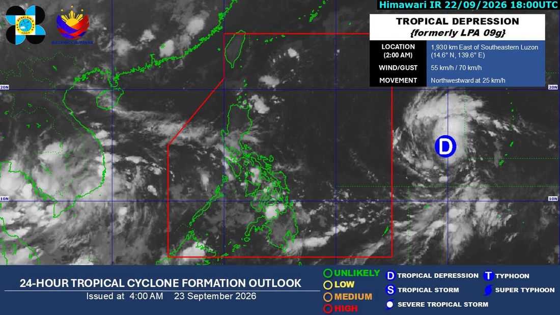
The tropical depression being monitored outside the Philippine Area of Responsibility (PAR) is expected to enter the country on Thursday morning or afternoon, Sept. 24, and may enhance the southwest monsoon, or Habagat, the Philippine Atmospheric, Geophysical and Astronomical Services Administration (PAGASA) said Wednesday.
In PAGASA’s 5 a.m. weather bulletin, weather specialist Chenel Dominguez said the weather disturbance was last located around 1,920 kilometers east of southeastern Luzon, packing maximum sustained winds of 55 kilometers per hour near the center and gustiness of up to 70 kph. It was moving northwestward at 25 kph.
PAGASA said the tropical depression is currently not directly affecting any part of the country.
Once the tropical cyclone enters the PAR, it will be given the local name Queenie.
Based on the forecast track, the system is expected to enter the PAR as a tropical storm and could reach typhoon strength while within the PAR.
"Sa ating forecast track papasok ito bilang isang ganap na tropical storm category at dito sa loob ng ating Philippine Area of Responsibility nakikita natin ang kanyang highest category ay typhoon category. Pero kung makikita din po natin, palayo po ito ng ating kalupaan kaya hindi natin inaasahan na magkakaroon po tayo ng landfall scenario dito sa malaking bahagi ng ating bansa," Domiguez said.
"Pero inaasahan po natin posible pa rin itong humila ng habagat. Pero hindi na natin inaasahan na makakaranas pa tayo ng mga malawakang pag-ulan katulad po ng mga nangyari nung mga nakaraang buwan kahit hihilain po nito ang ating habagat," she added.
For Wednesday, Luzon is expected to generally experience fair weather, although hot and humid conditions may persist from noon to afternoon. Isolated rain showers and thunderstorms are also possible, particularly in the afternoon and evening due to localized thunderstorms.
The trough of tropical depression, or extension of its cloudiness, is bringing a higher chance of rain over parts of the eastern Visayas and Mindanao.
Meanwhile, a higher chance of rain is expected over Eastern Visayas, Caraga, Misamis Oriental, Camiguin, and Davao Oriental due to the tropical depression's trough.
The rest of the Visayas and Mindanao, as well as Palawan, are expected to have generally fair weather, although localized thunderstorms may still develop in the afternoon and evening.
PAGASA said there are currently no gale warnings in effect over any of the country's seaboards.
