
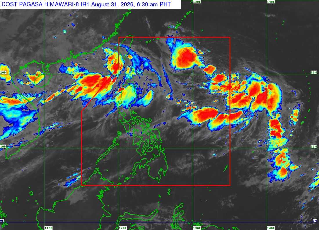
Tropical Depression Pilandok slightly intensified as it meandered over the Philippine Sea east of extreme Northern Luzon early Monday, the Philippine Atmospheric, Geophysical and Astronomical Services Administration (PAGASA) said on Monday, August 31.
In its 5 a.m. weather forecast, the center of Pilandok was estimated at 1,130 kilometers east of Extreme Northern Luzon.
Pilandok was packing maximum sustained winds of 55 kilometers per hour near the center, with gustiness of up to 70 kph.
PAGASA said the tropical depression may briefly intensify into a tropical storm on Tuesday, September 1. However, it is expected to weaken back into a tropical depression by Wednesday as it moves generally toward the Ryukyu Islands.
The weather bureau said Pilandok is expected to remain far from the Philippine landmass, with a low chance of making landfall.
Pilandok is forecast to exit the Philippine Area of Responsibility (PAR) by Wednesday evening or early Thursday.
Meanwhile, PAGASA is monitoring two other tropical depressions over the northern West Philippine Sea (WPS).
One tropical depression was located 485 kilometers west-northwest of Itbayat, Batanes, while Tropical Depression Saudel was located around 1,180 kilometers west of Extreme Northern Luzon after redeveloping early Monday.
PAGASA said Saudel and the other tropical depression may undergo binary interaction, which could influence their movement. Saudel may move toward southeastern China and potentially re-enter the northwestern portion of the PAR.
If Saudel re-enters the PAR, it will be assigned the local name “Obet.”
The three tropical depressions are expected to enhance the southwest monsoon, or “habagat,” which continues to affect Luzon and the western portions of the Visayas.
PAGASA said heavy to intense rains may continue over parts of Central Luzon through Tuesday evening and over the western portions of Northern Luzon through Wednesday.
The weather bureau warned that the risk of flooding and landslides remains high over western Luzon, particularly in areas that have already received significant rainfall.
Monsoon rains are expected over the Ilocos Region, Abra, Benguet, Bataan, Zambales, Tarlac, and Pampanga.
Occasional rains will prevail over the rest of the Cordillera Administrative Region, Batanes, the Babuyan Islands, Nueva Vizcaya, Nueva Ecija, and Bulacan due to the southwest monsoon.
Metro Manila, Calabarzon, the rest of Cagayan Valley, Aurora, Occidental Mindoro, Oriental Mindoro, Marinduque, Romblon, Aklan, and Antique may experience cloudy skies with scattered rains and thunderstorms.
Meanwhile, the rest of Luzon, the Negros Island Region, and the rest of Western Visayas will have partly cloudy to cloudy skies with isolated rain showers or thunderstorms.
Localized thunderstorms are also expected over Mindanao and the rest of the Visayas.
PAGASA also said a low-pressure area over the vicinity of Micronesia has a medium potential for tropical cyclone development within the next 24 hours.
The agency said there remains high uncertainty over whether the system will enter the PAR and noted that it has no direct effect on the country's weather at present.
PAGASA advised the public, particularly those in flood-prone areas, to remain alert as continued monsoon rains may trigger flooding and landslides.
