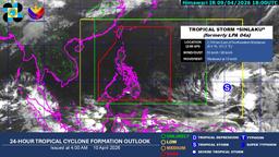
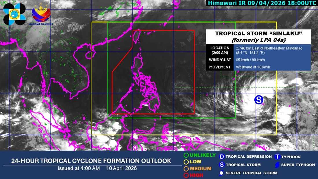
The tropical depression outside the Philippine Area of Responsibility (PAR) has intensified into a tropical storm on Thursday night, April 9.
As of 2:00 a.m on Friday, the tropical storm with international name "Sinlaku" was located approximately 2,740 kilometers east of Northeastern Mindanao, still outside the PAR but within PAGASA’s Tropical Cyclone Information Domain (TCID).
The weather bureau said the storm packs maximum sustained winds of 65 kilometers per hour near the center, with gusts reaching up to 80 km/h, and is moving westward at 10 km/h.
According to PAGASA, the TCID is its largest and outermost monitoring domain, where weather systems are tracked primarily for early monitoring and public awareness.
“Tropical cyclones present inside the TCID are of least concern for the forecasters but are necessary enough for monitoring and public awareness purposes,” the agency said.
Meanwhile, in its 4:00 a.m. forecast, PAGASA said the ridge of a High Pressure Area (HPA) continues to extend over Northern and Central Luzon.
The rest of the country, including Metro Manila, can expect partly cloudy to cloudy skies with isolated rain showers or thunderstorms in the next 24 hours due to localized thunderstorms.
PAGASA advised the public to remain vigilant, especially during thunderstorms, which may cause flash floods or landslides.