
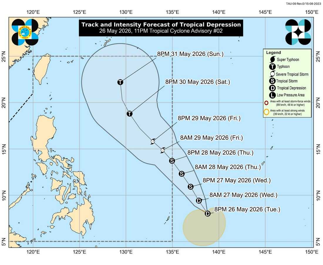
A tropical depression outside the Philippine Area of Responsibility (PAR) may enter the country’s monitoring area on Thursday afternoon or evening and will be given the local name “Domeng,” according to the state weather bureau.
As of 3:00 a.m. on Wednesday, the tropical depression was located 1,230 kilometers east of Northeastern Mindanao, packing maximum sustained winds of 55 kilometers per hour near the center and gustiness of up to 70 kph while moving west northwestward at 10 kph.
PAGASA said the weather disturbance may enter PAR as a tropical storm and could intensify into a typhoon by Saturday over the Philippine Sea.
The agency noted that the cyclone is less likely to make landfall in the country, but its winds may still affect Extreme Northern Luzon, where Wind Signal No. 1 may be raised during its passage.
Moderate to rough sea conditions are also possible over the seaboards of Extreme Northern Luzon this weekend, with gale warnings likely to be issued.
Meanwhile, the southwest monsoon or “habagat” may also be enhanced by the tropical cyclone beginning Saturday.
On Wednesday, due to the southwesterly windflow, cloudy skies with scattered rains and thunderstorms are expected over the Zamboanga Peninsula, Bangsamoro Autonomous Region in Muslim Mindanao (BARMM), SOCCSKSARGEN, Lanao del Norte, Misamis Occidental, and Palawan.
The trough of the tropical depression, meanwhile, will bring cloudy skies with scattered rains and thunderstorms over the rest of Mindanao.
Metro Manila and the rest of the country will experience partly cloudy to cloudy skies with isolated rainshowers or thunderstorms caused by localized thunderstorms.
Sunrise was at 5:26 a.m. while sunset is expected at 6:20 p.m.
