
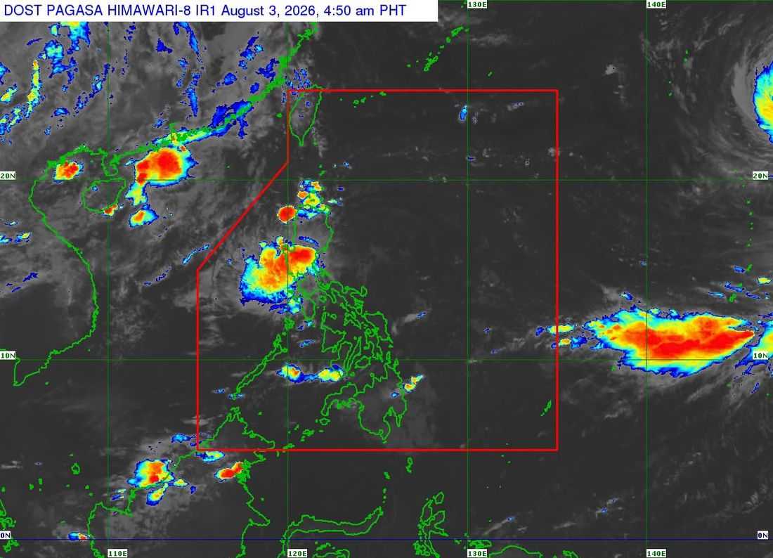
Tropical Depression Luis maintained its strength while moving over the sea east of Aurora on Monday, Aug. 3, as Signal No. 1 remained in effect over 10 areas in Northern Luzon, according to the state weather bureau.
In its 5 a.m. weather bulletin, the Philippine Atmospheric, Geophysical and Astronomical Services Administration (PAGASA) said the center of Tropical Depression Luis was estimated at 130 kilometers east-southeast of Casiguran, Aurora.
The tropical cyclone was packing maximum sustained winds of 55 kilometers per hour near the center and gusts of up to 70 kph.
PAGASA said Luis is moving generally northwestward and may make landfall or pass close to Northern Luzon on Monday night or early Tuesday morning, August 3.
“May posibilidad na nga maglandfall ‘yan sa pagitan ng Isabela at Aurora area mamayang gabi o bukas ng madaling araw,” Charmagne Varilla, a PAGASA weather specialist said during an interview on DZRH's Dos Por Dos.
The weather bureau, however, stressed that heavy rainfall and strong winds may still affect areas outside the forecast landfall point and confidence cone, adding that the cyclone's track remains highly uncertain and could still shift in succeeding advisories.
After approaching or crossing Northern Luzon, Luis is forecast to sharply turn east-northeastward while moving away from the Philippine landmass.
PAGASA said the tropical depression is expected to remain at its current intensity for most of the forecast period before weakening into a remnant low by Wednesday, Aug. 5. It is then expected to be fully absorbed into the circulation of Tropical Cyclone Dolphin.
Meanwhile, the southwest monsoon, enhanced by the outer circulation of Luis, is expected to bring strong to gale-force wind gusts over most of Luzon and the Visayas, as well as Lanao del Norte, Misamis Occidental, Camiguin, Surigao del Norte, Dinagat Islands, Sarangani, Davao Occidental, and Davao Oriental through Tuesday, particularly in coastal and upland areas.
As of Monday morning, Tropical Cyclone Wind Signal No. 1 remained in effect over the following areas:
- The central and eastern portions of Cagayan (Enrile, Tuguegarao City, Peñablanca, Piat, Santo Niño, Camalaniugan, Tuao, Lal-Lo, Gonzaga, Alcala, Amulung, Santa Teresita, Baggao, Buguey, Solana, Rizal, Santa Ana, Gattaran, Iguig, Lasam, Aparri, Ballesteros, Abulug, Allacapan, Pamplona)
- Isabela
- Quirino;
- The eastern and southern portions of Apayao (Flora, Santa Marcela, Conner, Pudtol, Luna)
- The eastern portion of Kalinga (City of Tabuk, Tanudan, Pinukpuk, Rizal)
- The eastern portion of Mountain Province (Paracelis, Natonin)
- The eastern portion of Ifugao (Aguinaldo, Alfonso Lista)
- The northern portion of Aurora (Dinalungan, Casiguran, Dilasag, Dipaculao, Baler)
- Polillo Islands
- The northern portion of Camarines Norte (Daet, Talisay, Paracale, Jose Panganiban, Capalonga, Vinzons)
PAGASA advised residents in affected areas to monitor the latest weather updates and take necessary precautions against possible heavy rains, strong winds, and other hazards associated with TD Luis.
