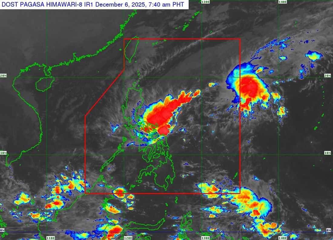
Tropical Depression Wilma picked up speed early Saturday as it continued to move westward over the waters east of Eastern Visayas, the Philippine Atmospheric, Geophysical and Astronomical Services Administration (PAGASA) reported in its morning weather bulletin.
As of 8 a.m., Wilma was last spotted 70 kilometers east of Borongan City, Eastern Samar, and is expected to make landfall in Eastern Samar at some point today, forecasters said.
Wilma currently carries maximum sustained winds of 45 kilometers per hour near the center and gusts of up to 55 kph. It is moving west at 15 kph. Its area of strongest winds extends up to 220 kilometers from the center.
Based on PAGASA’s latest track scenario, the cyclone is forecast to cross parts of the Visayas today and Sunday, and may emerge over the Sulu Sea by Sunday afternoon. It could pass near the northern portion of Palawan before reaching the West Philippine Sea by late Sunday or early Monday.
Wilma is projected to exit the Philippine Area of Responsibility (PAR) by early Tuesday morning.
Signal No. 1 Areas:
Luzon:
Sorsogon, Masbate (including Ticao and Burias Islands), Romblon, southern Oriental Mindoro (Bulalacao, Mansalay, Roxas, Bongabong), southern Occidental Mindoro (Magsaysay, San Jose, Rizal, Calintaan), and the northernmost portion of Palawan (Araceli, Dumaran, El Nido, Taytay), including Cuyo, Calamian, and Cagayancillo Islands.
Visayas:
Northern Samar, Eastern Samar, Samar, Biliran, Leyte, Southern Leyte, Cebu (including Bantayan and Camotes Islands), Bohol, Negros Occidental, Siquijor, northern and central Negros Oriental, Guimaras, Iloilo, Capiz, Aklan, and Antique.
Mindanao:
Surigao del Norte (including Siargao and Bucas Grande Islands), Dinagat Islands, northern Surigao del Sur, northern Agusan del Norte, and Camiguin.
PAGASA urged residents in areas under wind signals to remain alert for strong winds and possible impacts. The agency also warned that even areas not under storm signals may still experience powerful gusts due to the surge of the northeast monsoon (amihan), which is affecting almost all of Luzon, Visayas, and parts of the Zamboanga Peninsula.
Meanwhile, a gale warning is in effect over the eastern seaboards of Luzon and Visayas, where sea conditions are expected to be rough to very rough. PAGASA advised small vessels and fishing boats to avoid sailing due to dangerous sea conditions.
The public is urged to monitor official updates and take necessary precautions as Wilma approaches land.