
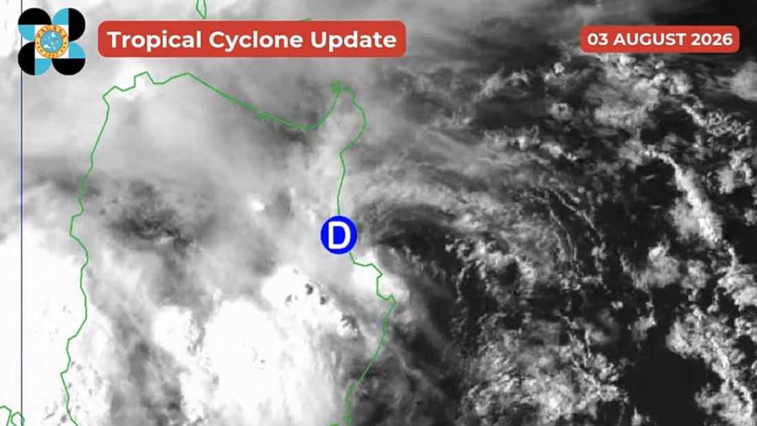
As of 5:30 PM on Monday, August 3, Tropical Depression Luis made landfall over Maconacon, Isabela.
In its recent update at 5:00 PM the PAGASA said that ‘Luis’ slightly accelerated, moving over the coastal waters of Divilacan, Isabela. It has maximum sustained winds of 45 km/h near the center, gustiness of up to 60 km/h, and a central pressure of 1002 hPa.
It is currently moving northwestward at 20 km/h.
Meanwhile, Tropical Cyclone Wind Signal (TCWS) No. 1 is in effect in the following parts of Luzon:
- The central and eastern portions of Cagayan (Enrile, Tuguegarao City, Peñablanca, Piat, Santo Niño, Camalaniugan, Tuao, Lal-Lo, Gonzaga, Alcala, Amulung, Santa Teresita, Baggao, Buguey, Solana, Rizal, Santa Ana, Gattaran, Iguig, Lasam, Aparri, Ballesteros, Abulug, Allacapan, Pamplona)
- Babuyan Islands (Camiguin Is., Fuga Is., Didicas Is.)
- Isabela
- Quirino
- The eastern and southern portions of Apayao (Flora, Santa Marcela, Conner, Pudtol, Luna)
- The eastern portion of Kalinga (City of Tabuk, Tanudan, Pinukpuk, Rizal)
- The eastern portion of Mountain Province (Paracelis, Natonin)
- The eastern portion of Ifugao (Aguinaldo, Alfonso Lista)
- The northern portion of Aurora (Dinalungan, Casiguran, Dilasag, Dipaculao)
According to the state weather bureau, after Luis makes landfall over Isabela, it will sharply turn east northeastward while moving away from the Philippine landmass. However, the PAGASA emphasized that the forecast track is highly uncertain and may change in the succeeding bulletins.
“LUIS is forecast to remain as a tropical depression over majority of the forecast period and may be downgraded into a remnant low by Wednesday (05 August) before becoming fully assimilated into the circulation of Tropical Cyclone DOLPHIN,” the PAGASA said.
In its 2:00 PM bulletin, the PAGASA said Typhoon Dolphin was located 2,650 km east northeast of Extreme Northern Luzon. It has maximum sustained winds of 150 km/h and gustiness of up to 185 km/h.
It was moving west northwestward at 25 km/h.
