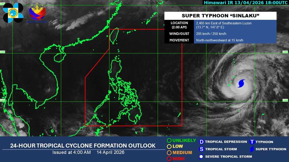
The super typhoon with the international name “Sinlaku” remains within the Tropical Cyclone Information Domain (TCID) of the PAGASA as of Tuesday, April 14.
As of 3:00 a.m., the eye of the super typhoon was estimated at 2,455 kilometers east of Southern Luzon. It is packing maximum sustained winds of 205 km/h near the center, with gusts reaching up to 250 km/h, and is moving northwestward at 15 km/h.
Meanwhile, a ridge of a High Pressure Area (HPA) continues to extend over Northern Luzon.
According to PAGASA’s weather forecast, Metro Manila and the rest of the country will experience partly cloudy to cloudy skies with isolated rain showers or thunderstorms due to localized thunderstorms.
PAGASA previously noted that although the tropical cyclone remains outside the Philippine Area of Responsibility (PAR), it may enter PAR in the latter part of the week. However, it currently has a low chance of making landfall over the country’s landmass.
The weather system will be named "Caloy" once it entered PAR.