
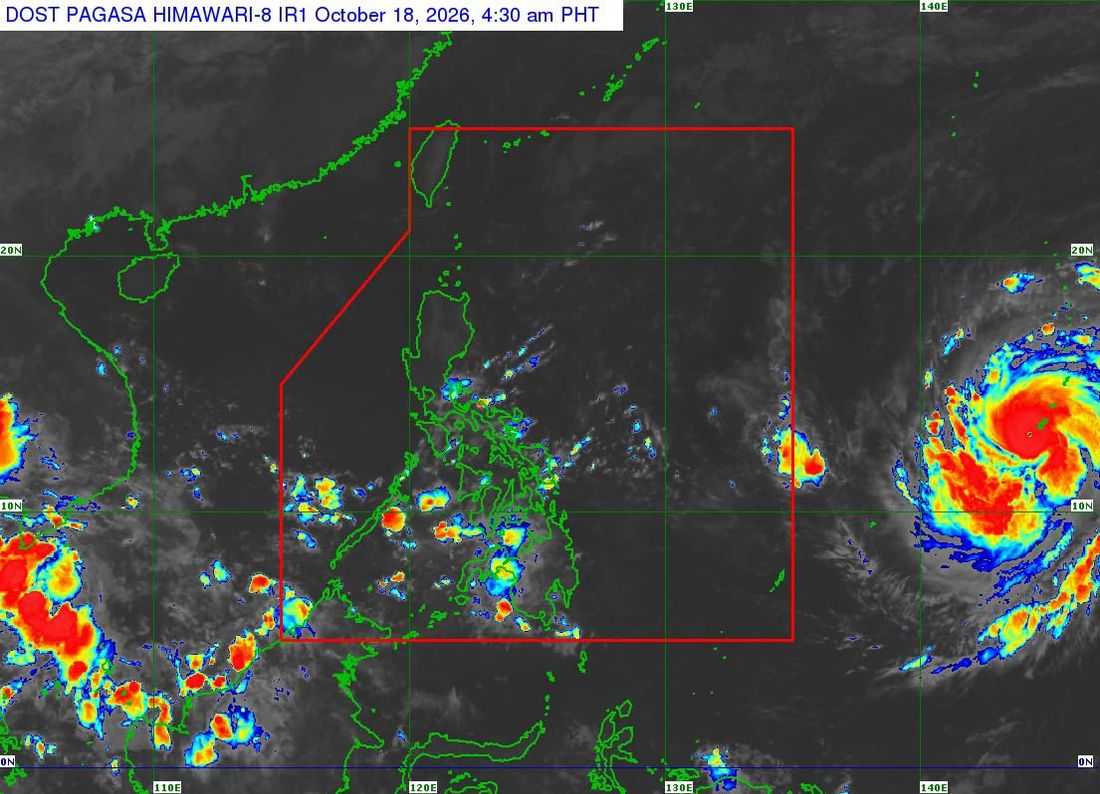
Super Typhoon Champi has intensified over the sea near Guam and is forecast to enter the Philippine Area of Responsibility (PAR) by Tuesday, October 20, potentially bringing strong winds, heavy rains and hazardous sea conditions to parts of the country, the state weather bureau said Sunday.
In its Tropical Cyclone Advisory No. 1 issued at 5 a.m. on October 18, the Philippine Atmospheric, Geophysical and Astronomical Services Administration (PAGASA) said Champi was located 2,230 kilometers east of southeastern Luzon, outside PAR, as of 4 a.m.
The super typhoon was packing maximum sustained winds of 185 kilometers per hour (km/h) near the center, with gusts of up to 230 km/h and a central pressure of 940 hectopascals.
It was moving west northwestward at 25 km/h, with strong to typhoon-force winds extending up to 480 kilometers from its center.
PAGASA said the cyclone is expected to maintain its super typhoon strength upon entering PAR, where it will be assigned the domestic name Rosal. It is forecast to continue moving west northwestward toward Taiwan, with gradual weakening likely to begin by Wednesday, October 21, after reaching its peak intensity.
Possible wind signals, heavy rains
PAGASA warned that tropical cyclone wind signals may be raised over the northern and eastern portions of Northern Luzon and parts of the Bicol Region as early as Monday evening, October 19, or Tuesday morning.
Under the current forecast scenario, the highest possible warning level is Wind Signal No. 3 or 4.
Gusty conditions are also expected over most parts of Luzon and the Visayas, as well as portions of Mindanao, beginning Wednesday or Thursday, October 21 to 22.
The weather bureau also warned of possible heavy rainfall over Extreme Northern Luzon and said it would issue a weather advisory ahead of the expected rains.
Meanwhile, moderate to rough seas may develop along the northern and eastern seaboards of Luzon and the eastern seaboards of the Visayas and Mindanao beginning Tuesday.
By Wednesday onward, very rough to very high seas may affect the northern and eastern seaboards of Luzon, prompting PAGASA to issue a gale warning on Tuesday evening or Wednesday morning.
PAGASA advised the public and concerned disaster risk reduction and management offices to closely monitor succeeding advisories and prepare for possible weather-related hazards.
