
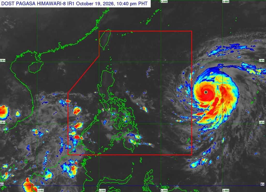
Super Typhoon Champi has further intensified while remaining outside the Philippine Area of Responsibility (PAR), according to the Philippine Atmospheric, Geophysical and Astronomical Services Administration (PAGASA) on Tuesday, October 20.
In its 4 a.m. weather forecast, PAGASA said Champi was located 1,605 kilometers east of Central Luzon as of 3 a.m., with maximum sustained winds of 195 kilometers per hour (kph) near the center and gusts of up to 240 kph.
The tropical cyclone was moving west-northwestward at 20 kph.
PAGASA said the trough of Champi is affecting the eastern sections of Southern Luzon and the Visayas, bringing cloudy skies with scattered rains and thunderstorms over Catanduanes, Northern Samar, and Eastern Samar.
Meanwhile, the easterlies are affecting Extreme Northern Luzon, while the Intertropical Convergence Zone (ITCZ) is bringing cloudy skies with scattered rains and thunderstorms over Palawan.
Metro Manila and the rest of the country will experience partly cloudy to cloudy skies with isolated rain showers or thunderstorms due to localized thunderstorms.
PAGASA warned of possible flash floods or landslides in areas that may experience moderate to, at times, heavy rainfall, as well as during severe thunderstorms.
