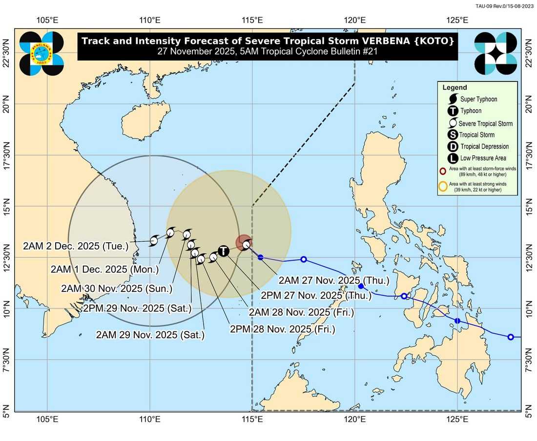
Severe Tropical Storm Verbena has exited the Philippine Area of Responsibility (PAR) and is moving west-northwestward over the sea north of the Kalayaan Islands, the Philippine Atmospheric, Geophysical and Astronomical Services Administration (PAGASA) reported in its 5:00 a.m. advisory.
While the storm is leaving Philippine waters, the Northeast Monsoon, enhanced by Verbena, continues to bring gusty winds and rough sea conditions over northern and western Luzon as well as parts of Palawan.
Strong to gale-force winds are expected today in Batanes, Cagayan, Apayao, Abra, Ilocos Norte, Ilocos Sur, Zambales, Bataan, Occidental Mindoro, and Palawan. These gusty conditions are forecast to persist in some areas until Saturday, PAGASA noted.
Coastal waters remain hazardous for sea travel, with rough to very rough conditions reported:
-
Up to 7 meters over the seaboards of the Kalayaan Islands
-
Up to 5.5 meters over the seaboards of Batanes, Babuyan Islands, and Ilocos Norte and Sur
-
Up to 5.0 meters over mainland Cagayan
Mariners are strongly advised to remain in port or seek safe harbor until conditions improve. Small vessels, including motorbancas, are warned against venturing out to sea.
PAGASA also highlighted that Verbena is expected to intensify further over the next 12 hours, potentially reaching typhoon strength, before gradually weakening due to the Northeast Monsoon surge.
The storm’s track will shift slowly west-southwestward tomorrow, then north-northwestward from Friday to Sunday, before resuming a west-southwestward direction for the remainder of the forecast period.
Despite its exit from the PAR, heavy rainfall and strong winds may still affect areas outside the storm’s immediate path, particularly in exposed coastal and upland regions.
Residents are urged to remain vigilant and monitor updates from local authorities.