
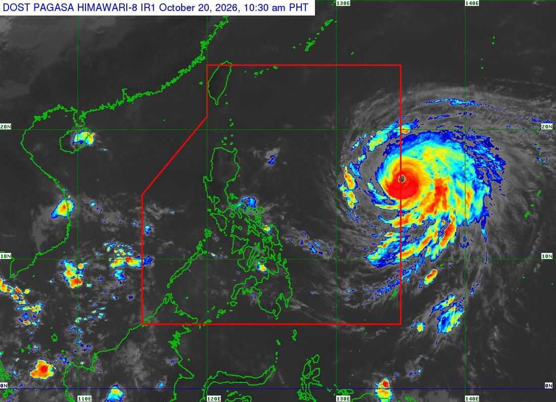
Super Typhoon Champi has entered the Philippine Area of Responsibility (PAR) and is given the local name “Rosal.”
As of 11:00 AM on Tuesday, October 20, the center of Super Typhoon Rosal was located 1,385 km east of Central Luzon, outside PAR. It has maximum sustained winds of 185 km/h near the center, gustiness of up to 230 km/h, and a central pressure of 940 hPa.
It is currently moving west northwestward at 25 km/h.
Tropical Cyclone Wind Signal (TCWS) No. 1 is currently hoisted in the following areas:
- Batanes, the eastern portion of Babuyan Islands (Babuyan Is., Camiguin Is., Didicas Is.)
- the eastern portion of mainland Cagayan (Santa Ana, Gonzaga, Lal-Lo, Santa Teresita, Camalaniugan, Aparri, Buguey, Gattaran, Baggao, Peñablanca)
- the northeastern portion of Isabela (Maconacon, Divilacan, Palanan, San Pablo, Cabagan, Santa Maria, Tumauini, Ilagan City)
- the northeastern portion of Catanduanes (Pandan, Bagamanoc, Panganiban, Viga, Gigmoto)
According to PAGASA, Rosal will move west northwestward until Wednesday, October 21, before moving generally northwestward until Friday (October 23) morning.
Rosal will begin to turn north northwestward to northward until it exits PAR by Friday evening or Saturday (October 24) early morning.
However, the state weather bureau noted that it may weaken into a typhoon on Thursday and may further weaken into a severe tropical storm on Saturday (October 24) evening or Sunday (October 25) morning while outside PAR due to “unfavorable environment.”
