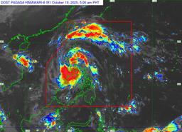
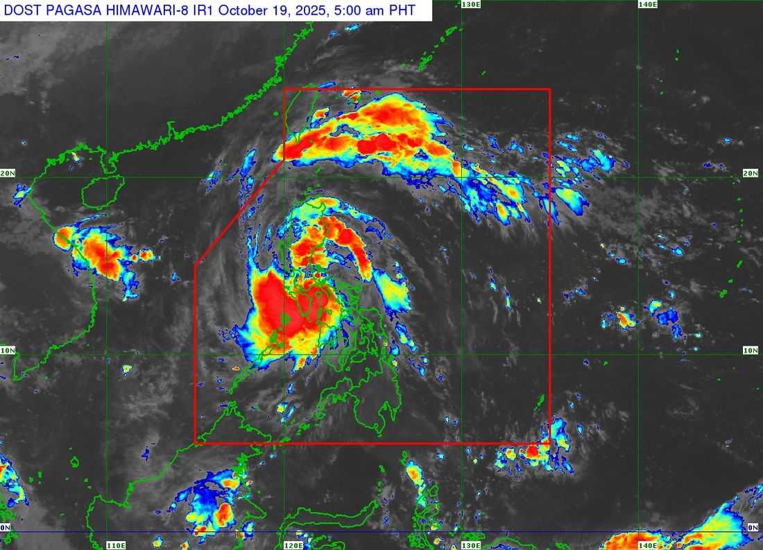
Tropical Storm Ramil has maintained its strength as it traverses the coastal waters of Alabat, Quezon, early Sunday morning, according to PAGASA.
As of 5:00 a.m., the center of Ramil was located over the waters off Alabat, Quezon, packing maximum sustained winds of 65 kilometers per hour (km/h) near the center and gustiness of up to 90 km/h, while moving west northwestward at 25 km/h.
PAGASA has raised Tropical Cyclone Wind Signal (TCWS) No. 2 over 17 areas:
- Southeastern portion of Quirino (Nagtipunan, Maddela, Aglipay)
- Central and southern portions of Nueva Vizcaya (Alfonso Castañeda, Dupax del Sur, Dupax del Norte, Bambang, Aritao, Kayapa, Santa Fe, Kasibu)
- Central and southern portions of Benguet (Itogon, Bokod, Atok, Kapangan, Tublay, La Trinidad, Baguio City, Tuba, Sablan)
- Central and southern portions of La Union (Rosario, Pugo, Tubao, Santo Tomas, Agoo, Aringay, Caba, Naguilian, Burgos, Bagulin, Bauang, City of San Fernando, San Juan, San Gabriel, Bacnotan, Santol, Balaoan, Luna)
- Pangasinan
- Aurora
- Nueva Ecija
- Bulacan
- Tarlac
- Pampanga
- Northern and central portions of Zambales (Santa Cruz, Candelaria, Masinloc, Palauig, Iba, Botolan, Cabangan)
- Northern portion of Metro Manila (Caloocan City, Quezon City, Valenzuela City, Marikina City, Malabon City, Navotas City)
- Northern and central portions of Rizal (Rodriguez, San Mateo, Antipolo City, Tanay, Baras)
- Northern portion of Laguna (Santa Maria, Famy, Siniloan)
- Northern and eastern portions of Quezon (General Nakar, Calauag, Tagkawayan, Guinayangan, Quezon, Alabat, Perez, Mauban, Real, Infanta, Atimonan, Plaridel, Gumaca, Lopez), Polillo Islands
- Camarines Norte
- Northwestern portion of Camarines Sur (Del Gallego, Ragay, Lupi, Sipocot)
Meanwhile, Signal No. 1 remains in effect over the following areas:
- Cagayan, including Babuyan Islands
- Isabela
- The rest of Quirino
- The rest of Nueva Vizcaya
- Apayao, Abra, Kalinga, Mountain Province, Ifugao
- The rest of Benguet
- Ilocos Norte, Ilocos Sur
- The rest of La Union
- The rest of Zambales
- Bataan
- The rest of Metro Manila
- The rest of Quezon, Rizal, Laguna
- Cavite, Batangas
- Occidental Mindoro, including Lubang Islands
- Oriental Mindoro, Marinduque, Romblon
- The rest of Camarines Sur
- Catanduanes, Albay, Sorsogon
- Northern and central portions of Masbate (Aroroy, Baleno, Mandaon, Milagros, Balud, Masbate City, Mobo, Uson, Dimasalang, Palanas, Cawayan), including Ticao and Burias Islands.
- Northern Samar
- The northern portion of Eastern Samar (Jipapad, San Policarpo, Oras, Arteche, Maslog)
- The northern portion of Samar (Matuguinao, Calbayog City, Gandara, Santa Margarita, Pagsanghan, Tagapul-An, Almagro, Santo Niño, San Jose de Buan)
PAGASA warned that the combined effects of Ramil’s outer rainbands and the easterlies will bring strong to gale-force winds over Cagayan Valley, Oriental Mindoro, Masbate, Caluya Islands, Samar, Eastern Samar, and Biliran, particularly in coastal and elevated areas.
The weather bureau also raised the possibility of a storm surge reaching up to 2.0 meters within 36 hours in low-lying coastal areas of Isabela, Ilocos Norte, Ilocos Sur, La Union, Pangasinan, Zambales, Aurora, Quezon, Marinduque, Camarines Norte, Camarines Sur, Catanduanes, Albay, and Masbate.
A gale warning is in effect over both the eastern and western seaboards of Luzon, where sea conditions are expected to be very rough with wave heights reaching up to 4.5 meters.
“Sea travel is risky for all types or tonnage of vessels. All mariners must remain in port or seek shelter until winds and waves subside,” PAGASA advised.
The agency cautioned that heavy rainfall, strong winds, and storm surges may still affect areas outside the storm’s projected path.
Ramil is forecast to make landfall over Quezon on Sunday morning, cross the Southern-Central Luzon landmass, and emerge over the coastal waters of Pangasinan or Zambales by Sunday afternoon or evening.
The tropical storm is expected to exit the Philippine Area of Responsibility (PAR) by Monday morning or noon.