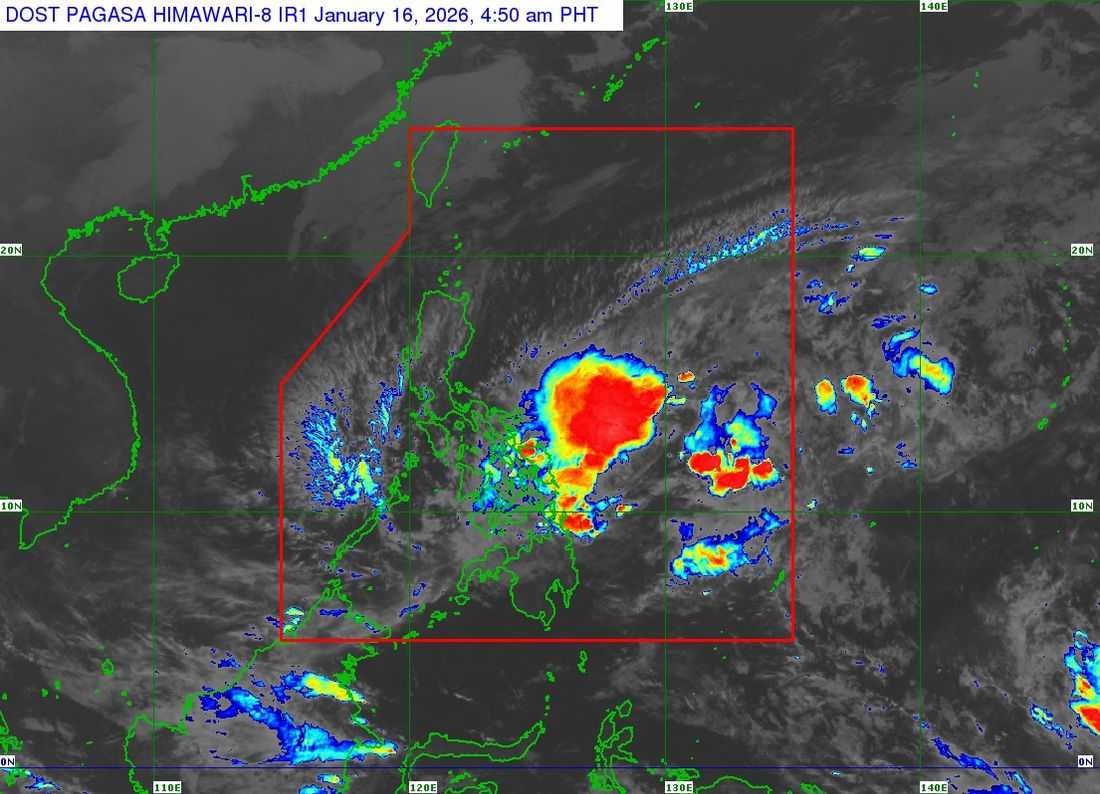
Tropical Storm Ada continues to move slowly north-northwestward over the Philippine Sea east of Eastern Visayas, according to DOST-PAGASA.
In its Tropical Cyclone Bulletin No. 8 issued at 5:00 a.m. on Friday, January 16, PAGASA said the center of Ada was located about 370 kilometers east of Surigao City, Surigao del Norte, or 430 kilometers east of Maasin City, Southern Leyte.
The storm has maximum sustained winds of 65 kilometers per hour near the center, gusts of up to 80 kilometers per hour, and a central pressure of 998 hectopascals.
Strong to gale-force winds extend up to 400 kilometers from the center of the storm.
Signal No. 1 raised in parts of Luzon, Visayas, and Mindanao
Tropical Cyclone Wind Signal No. 1 remains in effect over several areas, warning of strong winds with speeds ranging from 39 to 61 kilometers per hour and a lead time of up to 36 hours. PAGASA said impacts are expected to be minimal to minor.
In Luzon, Signal No. 1 is hoisted over Camarines Sur, Catanduanes, Albay, Sorsogon, the eastern portion of Camarines Norte, and the eastern portion of mainland Masbate, including Ticao and Burias Islands.
In the Visayas, areas under Signal No. 1 include Northern Samar, Samar, Eastern Samar, Biliran, the northern and central portions of Leyte, and the eastern portion of Southern Leyte.
In Mindanao, Signal No. 1 is in effect over Dinagat Islands, Surigao del Norte, and Surigao del Sur.
PAGASA said the highest wind signal that may be raised during the passage of Ada is Wind Signal No. 2.
Heavy rains, strong winds possible
Residents in affected areas were advised to monitor the Heavy Rainfall Outlook under Weather Advisory No. 8, as heavy rains may affect areas influenced by the storm.
Aside from Ada, the northeast monsoon and the storm’s outer circulation are expected to bring strong to gale-force gusts, especially in coastal and upland areas, over parts of Luzon, Visayas, and Caraga from Friday through Sunday.
Rough seas expected in eastern seaboards
PAGASA warned of rough to moderate seas in several coastal areas. Wave heights of up to 4.0 meters are expected along the northern and eastern seaboards of Catanduanes and Northern Samar, as well as the eastern coasts of Albay, Sorsogon, and Eastern Samar.
Seas of up to 3.5 meters may affect the eastern seaboards of Dinagat Islands and Surigao del Sur, as well as Siargao-Bucas Grande and Polillo Islands. Mariners of small seacrafts, including motorbancas, were advised not to venture out to sea under these conditions.
Track and intensity outlook
PAGASA said Tropical Storm Ada will generally move northwestward through Saturday before turning north-northwestward to northeastward by Sunday. The storm may pass close to Eastern Samar and Northern Samar on Saturday and near Catanduanes by Sunday.
Ada is expected to remain a tropical storm while over the sea east of the Visayas and Southern Luzon, but may weaken into a tropical depression by Tuesday.
Authorities urged the public and local disaster risk reduction and management offices to take necessary precautions to protect life and property, and to follow advisories and instructions from local officials.