
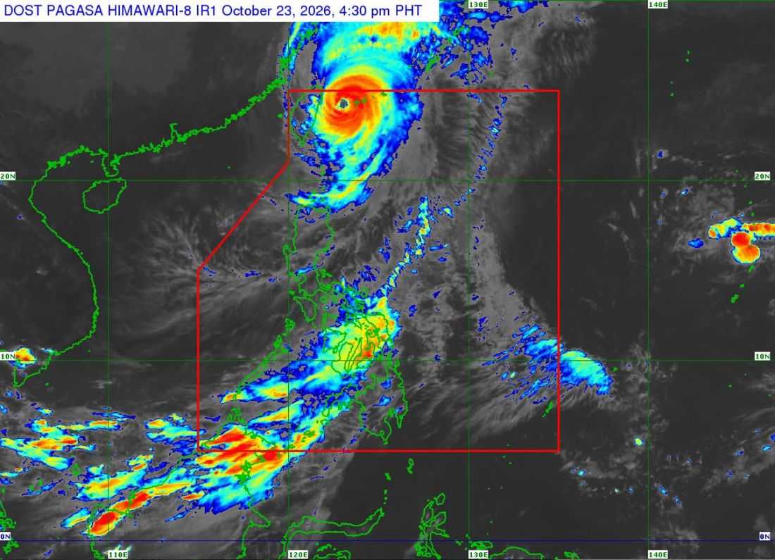
Typhoon Rosal slightly intensified while moving north northwestward over the sea east of Taiwan.
As of 5:00 PM on Friday, October 23, the typhoon was located at 385 km north northeast of Itbayat, Batanes. It has maximum sustained winds of 155 km/h near the center, gustiness of up to 190 km/h, and central pressure of 950 hPa.
It is currently moving north northwestward at 20 km/h.
Tropical Cyclone Wind Signal (TCWS) No. 2 is in effect in Batanes.
- Meanwhile, TCWS No. 1 is hoisted in the following areas:
- The northern portion of Cagayan (Santa Ana, Gonzaga, Lal-Lo, Santa Teresita, Camalaniugan, Aparri, Buguey, Gattaran, Baggao, Santa Praxedes, Claveria, Sanchez-Mira, Pamplona, Ballesteros, Abulug, Allacapan, Lasam)
- Babuyan Islands
- the northern portion of Ilocos Norte (Pagudpud, Adams, Bangui, Vintar, Burgos, Bacarra, Pasuquin, Carasi, Dumalneg)
- the northern portion of Apayao (Calanasan, Luna, Santa Marcela, Flora, Pudtol)
The state weather bureau said that Rosal will continue moving generally northwestward until Saturday morning, October 24, before moving northward then northeastward between Saturday afternoon and Sunday morning, October 25, towards Japan.
“On the forecast track, the tropical cyclone will exit the Philippine Area of Responsibility (PAR) tomorrow morning,” the PAGASA said.
The typhoon is expected to weaken within the forecast period and may downgrade into a severe tropical storm by Sunday morning.
