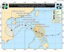
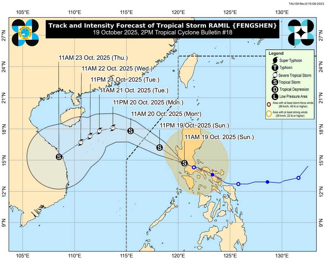
Tropical Storm Ramil continues to maintain its strength as it moves away from the Luzon landmass this Friday afternoon, according to the latest bulletin from the state weather bureau, the Philippine Atmospheric, Geophysical and Astronomical Services Administration (PAGASA).
As of 1:00 p.m., the center of Ramil was estimated in the vicinity of Olongapo City, Zambales (14.9°N, 120.3°E) with maximum sustained winds of 65 km/h near the center, gustiness reaching up to 90 km/h, and a central pressure of 998 hPa. It is currently moving west-northwestward at 15 km/h.
PAGASA said that Ramil’s strong to gale-force winds extend outwards up to 430 kilometers from the center.
Tropical Cyclone Wind Signal (TCWS) No. 2 remains hoisted over parts of Central and Northern Luzon, including:
-
Central and southern Benguet
-
Central and southern La Union
-
Pangasinan
-
Nueva Ecija
-
Bulacan
-
Tarlac
-
Pampanga
-
Zambales
-
Northern Bataan
-
Northern and central portions of Metro Manila (Quezon City, Manila, Makati, Pasig, Taguig, among others)
-
Northern and western Rizal
These areas may experience gale-force winds (62–88 km/h) within 24 hours, posing a minor to moderate threat to life and property.
TCWS No. 1 is also in effect over several other provinces, including Cagayan, Isabela, Quirino, Nueva Vizcaya, Abra, Bataan (remaining areas), Quezon, Laguna, Cavite, Batangas, Mindoro, Marinduque, Romblon, Camarines Norte, parts of Camarines Sur, and Burias Island. These areas may experience strong winds (39–61 km/h) within 36 hours.
Residents, especially those in flood- and landslide-prone areas, are urged to stay alert and follow evacuation orders from local authorities. Disaster Risk Reduction offices have been advised to implement precautionary measures to ensure public safety.
PAGASA further cautioned against possible flash floods, landslides, and coastal hazards, and encouraged the public to monitor updates through regional weather advisories and rainfall warnings.