Tropical Storm Ramil may make landfall in Northern Samar around noon or in the afternoon on Saturday, the Philippine Atmospheric Geophysical and Astronomical Services Administration (PAGASA) said.
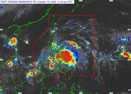
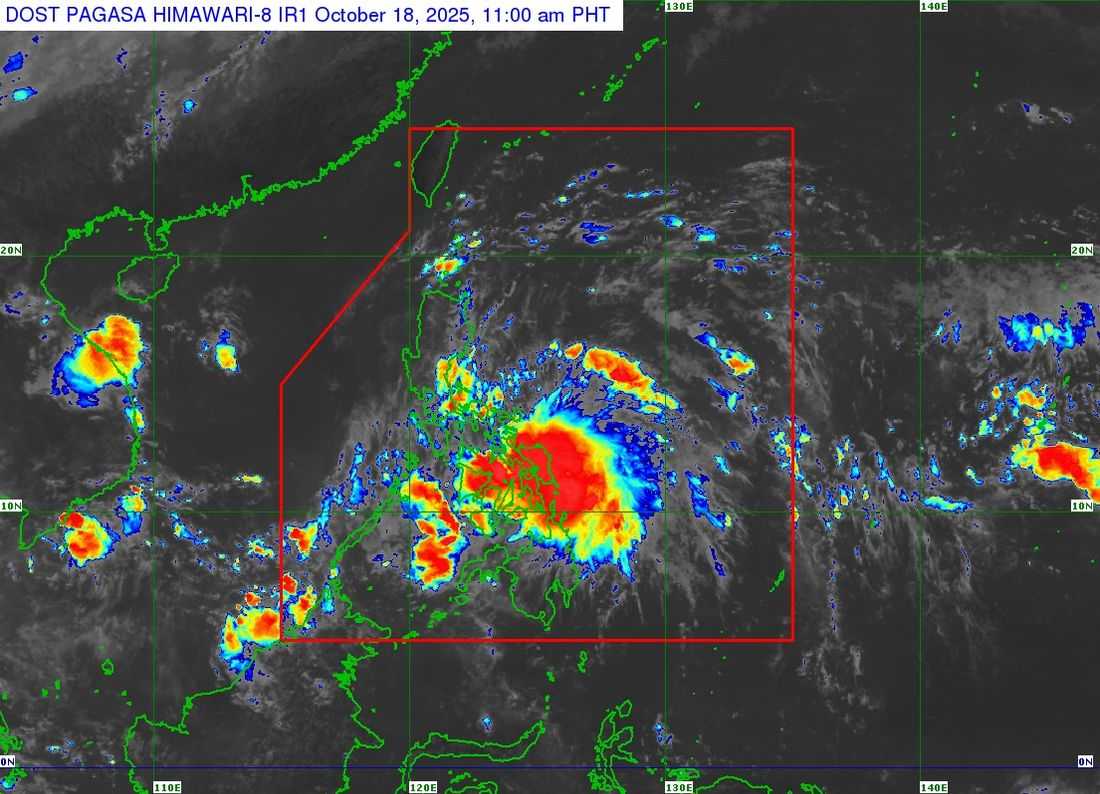
As of 11 a.m., the state weather bureau reported that the center of Ramil was located over the coastal waters of Palapag, Northern Samar.
The storm is moving west-southwest at 20 kilometers per hour (km/h), carrying maximum sustained winds of 75 km/h near the center and gusts reaching up to 90 km/h.
According to PAGASA, Ramil is expected to move generally west-northwest or northwest, following its brief west-southwest movement earlier in the day.
"The center of Ramil may make landfall or pass close to Northern Samar this noon or early afternoon, then over Catanduanes this afternoon or evening," PAGASA said in its latest bulletin.
"After po ng landfall po nito dito sa may area po ng Catanduanes ay maaari din po itong maglandfall dito sa may area po ng Aurora bukas ng umaga or ng hapon," said weather specialist, Munir Baldomero in an exclusive interview in RH Balita.
The possibility of landfall over Albay or Sorsogon is increasing, PAGASA said. Afterward, the storm is expected to continue moving west-northwestward, passing close to or over the mainland Bicol Region and the Polillo Islands.
Tropical Cyclone Wind Signals (TCWS) have been raised in the following areas:
Signal no.2
- Luzon
- The northern portion of Aurora (Casiguran, Dilasag, Dinalungan), Polillo Islands, Camarines Norte, Catanduanes, the northern portion of Camarines Sur (Tinambac, Siruma, Goa, San Jose, Lagonoy, Garchitorena, Caramoan, Presentacion), the extreme eastern portion of Albay (Rapu-Rapu), and the northeastern portion of Sorsogon (Prieto Diaz)
- Visayas
- The northeastern portion of Northern Samar (Laoang, Palapag, Mapanas, Pambujan, San Roque, Mondragon, Gamay)
Signal no.1
- Luzon
- Cagayan including Babuyan Islands, Isabela, Quirino, Nueva Vizcaya, Apayao, Abra, Kalinga, Mountain Province, Ifugao, Benguet, Ilocos Norte, Ilocos Sur, La Union, Pangasinan, the rest of Aurora, Nueva Ecija, the eastern portion of Bulacan (Doña Remedios Trinidad, Norzagaray, San Miguel, San Ildefonso, San Rafael, Angat), the eastern portion of Tarlac (Camiling, San Clemente, Santa Ignacia, Paniqui, Moncada, San Manuel, Anao, Ramos, Pura, Victoria, City of Tarlac, La Paz, Concepcion, Gerona), the eastern portion of Pampanga (Magalang, Arayat, Candaba), the northern and eastern portions of Quezon (Tagkawayan, Perez, Alabat, Quezon, Atimonan, Padre Burgos, Unisan, Gumaca, Plaridel, Agdangan, Pagbilao, Mauban, Calauag, Guinayangan, Lopez, Pitogo, Macalelon, General Luna, Catanauan, San Narciso, Buenavista, San Francisco, San Andres, Mulanay, General Nakar, Infanta, Real, Sampaloc), the rest of Camarines Sur, the rest of Albay, the rest of Sorsogon, Burias Island, and Ticao Island
- Visayas
- Northern Samar, the northern portion of Eastern Samar (San Policarpo, Arteche, Oras, Dolores, Maslog, Jipapad, Taft, Can-Avid), and the northern portion of Samar (Matuguinao, San Jose de Buan, Calbayog City, Gandara, Santa Margarita, Pagsanghan, San Jorge, Tagapul-An, Almagro, Santo Niño, Tarangnan, Paranas, City of Catbalogan, Jiabong, Motiong)
Forecast Track
Ramil may make another landfall in the vicinity of Aurora Province tomorrow, October 19, in the morning or afternoon. However, the possibility of landfall over northern Quezon or southern Isabela cannot be ruled out, depending on shifts in the storm’s path.
After making landfall in Aurora, Ramil is expected to traverse the mountainous terrain of Northern Luzon and emerge over the coastal waters of Pangasinan or La Union by tomorrow evening. It is forecast to exit the Philippine Area of Responsibility (PAR) by Monday morning, October 20.