
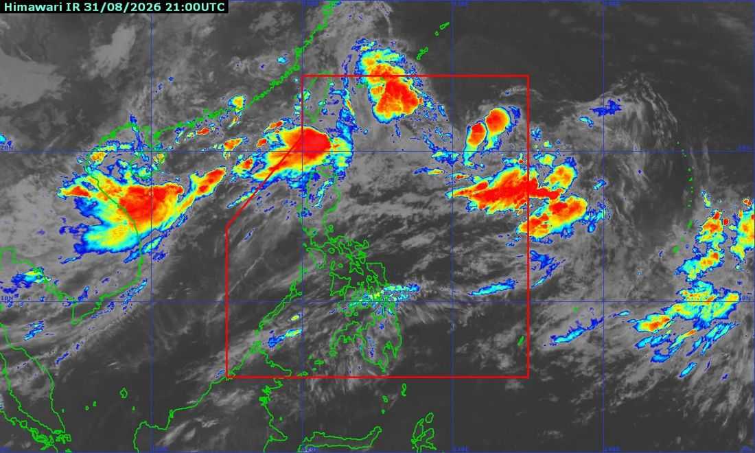
Tropical Depression Pilandok is expected to intensify into a tropical storm within the next 12 hours, but remains unlikely to make landfall in the Philippines, according to the Philippine Atmospheric, Geophysical and Astronomical Services Administration (PAGASA).
In its Tropical Cyclone Bulletin No. 8 issued at 5 a.m. Tuesday, September 1, PAGASA said Pilandok was maintaining its strength as it moved west-northwestward at 10 kilometers per hour.
As of 4 a.m., the center of Pilandok was estimated at 1,050 kilometers east of Extreme Northern Luzon, with maximum sustained winds of 55 kph near the center, gustiness of up to 70 kph, and a central pressure of 1,000 hPa.
No Tropical Cyclone Wind Signal is currently in effect over any part of the country.
PAGASA said Pilandok is forecast to slowly turn east-northeastward and then northward within the next 24 hours before moving generally north-northwestward for the remainder of the forecast period.
The weather bureau expects the cyclone to exit the Philippine Area of Responsibility (PAR) by Wednesday evening, September 2, or Thursday morning, September 3.
Pilandok is also forecast to intensify into a tropical storm and may maintain its strength as it moves toward southern Japan.
Despite Pilandok's distance from the country, PAGASA warned that the Southwest Monsoon or Habagat will continue to bring strong to gale-force wind gusts over most of Luzon and Visayas, as well as parts of Mindanao, until Thursday.
Meanwhile, a Gale Warning remains in effect over the northern and western seaboards of Northern Luzon.
PAGASA also warned of very rough to rough seas in several coastal areas, with waves reaching up to 5 meters along the western seaboard of the Babuyan Islands and the seaboards of Ilocos Norte.
Sea travel is considered risky for all types and tonnage of vessels in areas under very rough sea conditions. Mariners are advised to remain in port or seek safe harbor until winds and waves subside.
PAGASA reiterated that heavy rainfall and severe winds may still occur in areas outside Pilandok's forecast track and confidence cone due to the effects of the Southwest Monsoon.
The next tropical cyclone bulletin will be issued at 11 a.m. Tuesday.
