
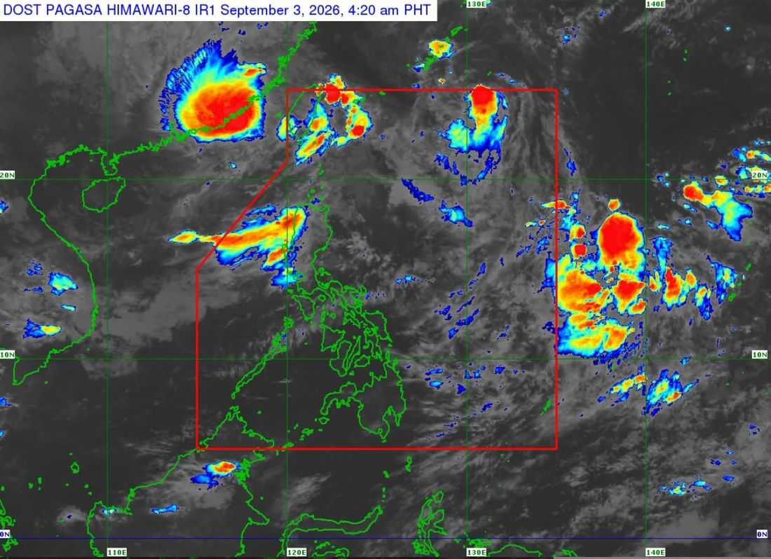
Tropical Storm Pilandok (international name: Krovanh) exited the Philippine Area of Responsibility (PAR) early Thursday, September 3, and is not directly affecting the country, according to the Philippine Atmospheric, Geophysical and Astronomical Services Administration (PAGASA).
In its 5 a.m. weather briefing, weather specialist Leanne Loreto said Pilandok exited the PAR at 4:30 a.m. and was last located about 1,030 kilometers east-northeast of Extreme Northern Luzon as of 4 a.m. It was packing maximum sustained winds of 75 kilometers per hour near the center, with gusts of up to 90 kph, and was moving northwestward at 20 kph.
PAGASA said Pilandok is not directly affecting the country and is unlikely to re-enter the PAR. The storm may follow a looping track near the Ryukyu Islands in Japan, including Okinawa and the Amami Islands, due to the influence of a high-pressure area, beginning Friday until Saturday.
Meanwhile, Tropical Storm Saudel (formerly Obet), also intensified and was located about 460 kilometers northwest of Itbayat, Batanes, as of 3 a.m.
Saudel was packing maximum sustained winds of 75 kph and gusts of up to 90 kph. It was moving north-northeastward at 15 kph but is expected to turn westward and make landfall over Guangdong, China, within Thursday.
Like Pilandok, Saudel is not expected to re-enter the PAR.
However, PAGASA said it will continue to enhance the southwest monsoon or Habagat, which remains the main weather system affecting the country.
PAGASA is also monitoring a low-pressure area (LPA) over the Philippine Sea, east of Central Luzon. The weather disturbance has become less likely to develop into a tropical cyclone within the next 24 hours.
The weather bureau said the three systems outside the PAR are not directly affecting the Philippines, but their interaction with the Habagat is contributing to the prevailing weather conditions.
Moderate to heavy rains may continue over the western section of Luzon on Thursday, with rainfall expected to shift southward toward Central Luzon and the western portions of Southern Luzon and Panay toward the weekend.
PAGASA warned that flooding and landslides remain possible, particularly in areas that have already experienced prolonged rainfall.
Rainfall of up to 100 millimeters may affect parts of Ilocos Norte, Abra, Ilocos Sur, La Union, Benguet, Pangasinan, Zambales, Bataan, and Occidental Mindoro.
The weather bureau also expects the rain to become more concentrated over the southwestern portion of Luzon beginning Friday, including Zambales, Bataan, Cavite, Batangas and Occidental Mindoro.
By Saturday, rainfall could reach 100 to 200 millimeters in some areas, particularly over the southwestern portion of Luzon, while parts of Central Luzon, Oriental Mindoro and Antique may receive up to 100 millimeters.
PAGASA also said strong winds associated with the Habagat may continue until Sunday over much of Luzon and the Visayas, as well as parts of Zamboanga del Norte, Misamis Occidental, Lanao del Norte, Misamis Oriental, Camiguin, Dinagat Islands, Davao Occidental and Davao Oriental.
Visayas and the rest of Luzon will experience partly cloudy to cloudy skies with isolated rain showers or thunderstorms due to the southwest monsoon or Habagat.
Meanwhile, Mindanao will have partly cloudy to cloudy skies with isolated rain showers or thunderstorms brought by localized thunderstorms.
