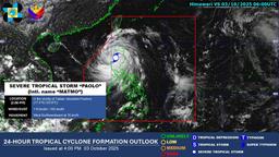
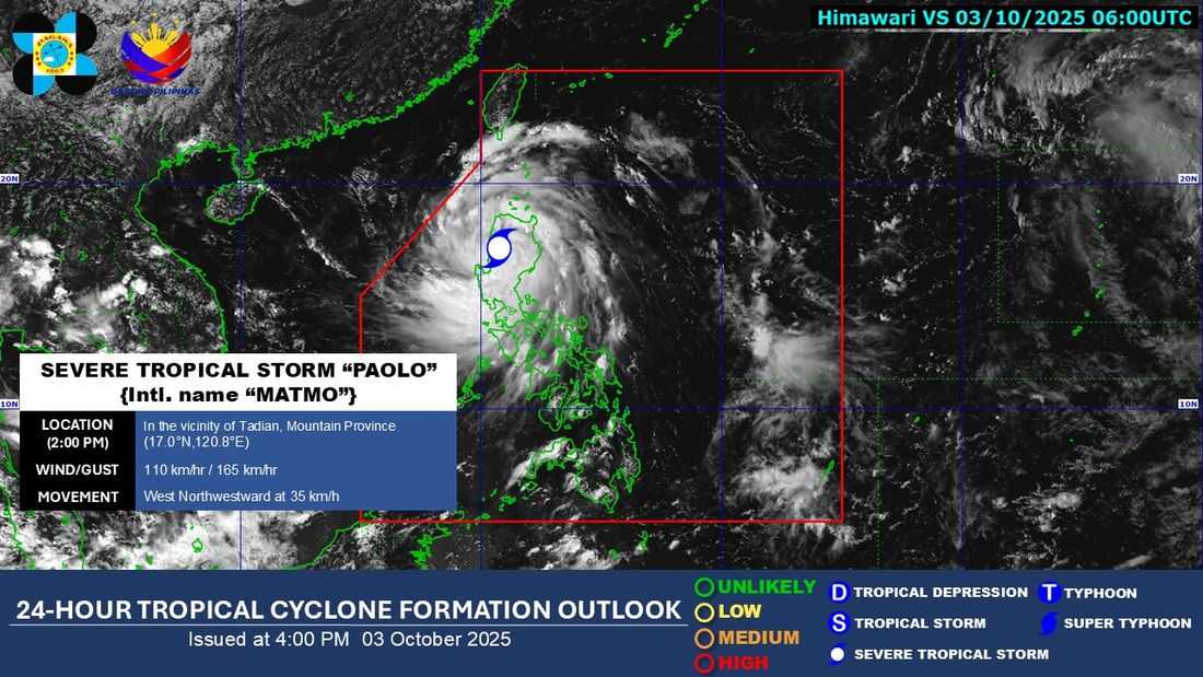
Tropical Cyclone Wind Signal No. 4 remains hoisted over several provinces as Typhoon "Paolo" slightly weakened into a Severe Tropical Storm while moving across the mountainous regions of Northern Luzon, the Philippine Atmospheric, Geophysical and Astronomical Services Administration (PAGASA) said in its 2 p.m. bulletin on Friday.
According to PAGASA, nine areas remain under Signal No. 4, including portions of Isabela, Quirino, Nueva Vizcaya, Mountain Province, and Ifugao. The state weather bureau warned residents of these areas to brace for destructive winds and intense rainfall.
As of 2:00 p.m., Typhoon Paolo weakened into a Severe Tropical Storm as it was last spotted in the vicinity of Tadian, Mountain Province. It was packing maximum sustained winds of 110 kilometers per hour near the center and gusts of up to 165 km/h, moving west-northwest at 35 km/h.
The weather bureau said Paolo is forecast to continue crossing the rugged terrain of Northern Luzon, where it may weaken further before exiting into the West Philippine Sea.
Meanwhile, lower tropical cyclone wind signals remain raised in other parts of the country, with Signal Nos. 1 to 3 in effect over several areas in Luzon and nearby regions.
The typhoon is forecast to exit landmass by late this afternoon or evening before moving outside the Philippine Area of Responsibility (PAR) by tomorrow morning, Saturday, October 3.