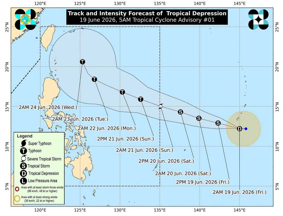
The low pressure area being monitored east of Visayas has intensified into a tropical depression and could develop into a typhoon by Sunday, June 21, as it moves toward the Philippine Area of Responsibility (PAR).
In its 5 a.m. Tropical Cyclone Advisory No. 1 issued Friday, PAGASA said the center of the tropical depression was estimated at 2,085 kilometers east of Eastern Visayas, still outside the PAR.
The weather disturbance packs maximum sustained winds of 55 kilometers per hour near the center, gusts of up to 70 kph, and is moving westward at 15 kph.
PAGASA said the tropical cyclone is expected to move generally west northwestward and enter the PAR between Saturday evening and Sunday morning, when it will be assigned the local name "Francisco".
Forecasters said the system is likely to intensify into a tropical storm by Friday afternoon or evening and may further strengthen into a typhoon by Sunday as it traverses the warm waters of the Philippine Sea.
While the cyclone is less likely to make landfall in the country, PAGASA said the hoisting of Tropical Cyclone Wind Signal No. 1 over the eastern portions of Northern Luzon remains possible due to its proximity to the Philippine landmass.
The weather bureau also noted that the tropical depression is unlikely to directly affect weather conditions and sea conditions over the next three days. However, it may enhance the southwest monsoon, or Habagat, by Sunday, bringing rains over parts of the country.
PAGASA advised the public and local disaster risk reduction and management offices to continue monitoring updates on the developing weather system.