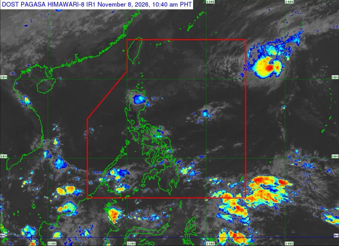
The Philippine Atmospheric, Geophysical and Astronomical Services Administration (PAGASA) said Severe Tropical Storm Cempaka may enter the Philippine Area of Responsibility (PAR) between Sunday evening, November 8, and early Monday morning, November 9.
In its Tropical Cyclone Advisory No. 2 issued at 11 a.m. Sunday, PAGASA said Cempaka was last located 1,720 kilometers east of extreme Northern Luzon, outside PAR, at 10 a.m.
Once it enters the country's monitoring area, the tropical cyclone will be given the domestic name Samuel.
Cempaka is packing maximum sustained winds of 110 kilometers per hour near the center, with gusts of up to 135 kph. It is moving westward at 25 kph, while strong to storm-force winds extend up to 380 kilometers from its center.
PAGASA said the storm is expected to continue moving generally west-northwestward before turning north-northeastward by Monday afternoon or evening and exiting through the northeastern boundary of PAR.
The weather bureau also forecast that Cempaka may intensify into a typhoon on Sunday and continue strengthening until it reaches its peak intensity. A gradual weakening is expected to begin by Tuesday, November 10.
Despite its possible entry into PAR, Cempaka is expected to remain over the Philippine Sea, far from land, and is not forecast to directly affect the country's weather or sea conditions.
However, PAGASA warned that the Northeast Monsoon, or Amihan, will bring moderate to rough seas over the seaboards of Northern and Central Luzon within the next 24 hours.
Very rough seas may affect the seaboards of Northern Luzon starting Tuesday, with a Gale Warning likely to be issued by Monday.
The public and concerned disaster risk reduction and management offices are advised to continue monitoring PAGASA's updates.