
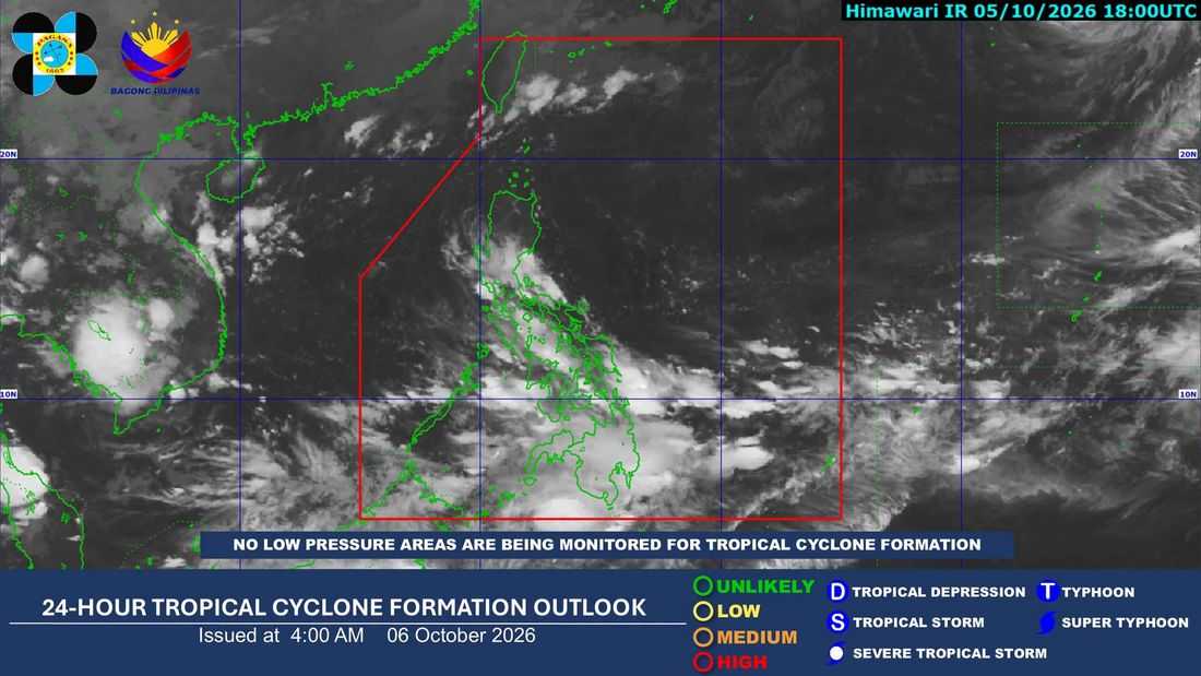
The Intertropical Convergence Zone (ITCZ) is expected to bring cloudy skies, scattered rainshowers and thunderstorms over parts of the country on Tuesday, October 6, according to the Philippine Atmospheric, Geophysical and Astronomical Services Administration (PAGASA).
In its 4 a.m. 24-hour public weather forecast, PAGASA said the ITCZ is affecting Palawan, Visayas, and Mindanao. These areas may experience cloudy skies with scattered rainshowers and thunderstorms, with moderate to at times heavy rains possibly causing flash floods and landslides.
Meanwhile, Metro Manila and the rest of Luzon may have partly cloudy to cloudy skies with isolated rainshowers or thunderstorms due to localized thunderstorms. PAGASA warned that severe thunderstorms may also trigger flash floods or landslides in vulnerable areas.
Batanes and the Babuyan Islands may experience cloudy skies with light rains due to the northeasterly windflow, although no significant impacts are expected.
For the wind forecast, extreme Northern Luzon may experience moderate to strong winds from the northeast, with moderate to rough coastal waters ranging from 1.2 to 3.1 meters.
The rest of Luzon and the eastern section of Visayas may experience light to moderate winds from the northeast to northwest, with slight to moderate seas.
PAGASA’s latest regional forecast also placed Mindanao under cloudy conditions with rainshowers and thunderstorms, with temperatures ranging from 25°C to 32°C in one forecast area.
Residents in areas prone to flooding and landslides are advised to remain alert and monitor PAGASA’s latest weather advisories.
