
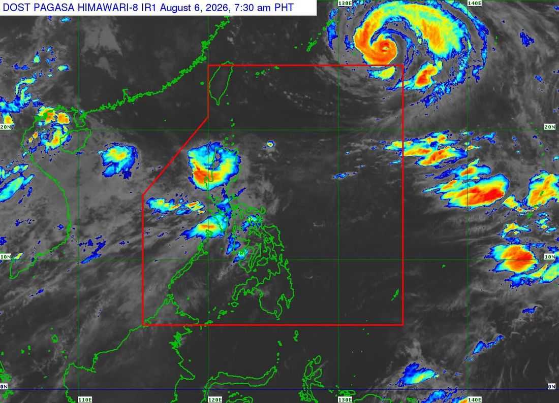
Tropical Storm "Maymay" (international name: Kujira) weakened as it moved over Abra on Thursday morning, but the Philippine Atmospheric, Geophysical and Astronomical Services Administration (PAGASA) warned that heavy rains, strong winds, flooding, landslides, and dangerous sea conditions continue to threaten several areas in Northern Luzon.
According to PAGASA's 8 a.m. bulletin, the center of the storm was estimated near Bangued, Abra, carrying maximum sustained winds of 65 kilometers per hour (kph) and gusts of up to 110 kph.
The weather disturbance was moving eastward at 10 kph, while strong to gale-force winds extended as far as 180 kilometers from the center.
PAGASA said "Maymay" is expected to continue weakening as it moves across the mountainous areas of Northern and Central Luzon. The storm may weaken into a tropical depression later in the day and could further deteriorate into a remnant low-pressure area by the afternoon or evening.
However, authorities warned that heavy rainfall, strong winds, flooding, landslides, and dangerous sea conditions remain possible even in areas outside the projected path of the storm.
Areas under Tropical Cyclone Wind Signal No. 2
The following areas remain under Tropical Cyclone Wind Signal (TCWS) No. 2, where wind speeds of 62 to 88 kph may pose a minor to moderate threat to life and property:
- Ilocos Norte
- Parts of Ilocos Sur
- Abra
- Portions of Apayao
- Parts of Kalinga
- Several areas in Mountain Province
Areas under Tropical Cyclone Wind Signal No. 1
TCWS No. 1 remains in effect over:
- The rest of Ilocos Sur
- La Union
- Northwestern Pangasinan
- The rest of Apayao, Kalinga, and Mountain Province
- Ifugao
- Benguet
- Southern portions of the Babuyan Islands
- Mainland Cagayan
- Isabela
- Quirino
- Nueva Vizcaya
- Northern and central Aurora
PAGASA also warned that the southwest monsoon, enhanced by the tropical cyclone, would bring strong to gale-force wind gusts across most parts of the country until Saturday.
Meanwhile, a gale warning remains in effect along the western seaboard of Northern Luzon, where waves could reach up to 4.5 meters.
Sea travel remains dangerous in the coastal waters of Ilocos Sur, La Union, Pangasinan, Ilocos Norte, and Batanes. Fisherfolk and operators of small vessels have been advised to remain in port until weather conditions improve.
PAGASA urged residents in areas vulnerable to flooding, landslides, and storm surges to remain vigilant and immediately follow evacuation orders issued by local authorities.
