
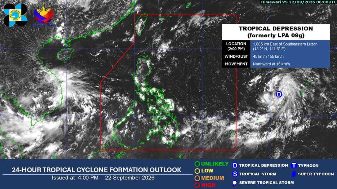
The low pressure area (LPA) being monitored outside the Philippine Area of Responsibility (PAR) has strengthened into a tropical depression, according to the Philippine Atmospheric, Geophysical and Astronomical Services Administration (PAGASA).
As of 2 p.m. Tuesday, September 22, the tropical depression was located approximately 1,885 kilometers east of Southeastern Luzon.
It was packing maximum sustained winds of 45 kilometers per hour (km/h) near the center, with gusts of up to 55 km/h. It was moving northward at 15 km/h, PAGASA said.
As of 4 p.m., PAGASA said the trough of the tropical depression was affecting the eastern sections of Visayas and Mindanao.
Eastern Visayas, Central Visayas, Caraga, Davao Region, Sorsogon, Masbate, Misamis Oriental, Bukidnon, and Camiguin will experience cloudy skies with scattered rain showers and thunderstorms due to the trough of the tropical depression.
Meanwhile, Palawan will have partly cloudy to cloudy skies with isolated rain showers or thunderstorms caused by the Southwest Monsoon.
Metro Manila and the rest of the country will experience partly cloudy to cloudy skies with isolated rain showers or thunderstorms due to localized thunderstorms.
