
DZRH Logo
LPA outside PAR now has 'high' chance of developing into tropical depression — PAGASA
Weather
LPA outside PAR now has 'high' chance of developing into tropical depression — PAGASA
by Mary Antalan26 May 2026
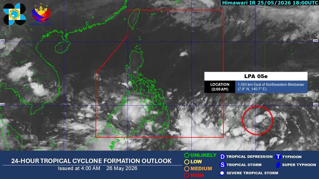
PHOTO COURTESY: PAGASA

The low pressure area (LPA) being monitored outside the Philippine Area of Responsibility (PAR) now has a high chance of developing into a tropical depression within the next 24 hours, according to PAGASA on Tuesday, May 26.

As of 2:00 a.m., the LPA was last spotted 1,585 kilometers east of Northeastern Mindanao.

Zamboanga Peninsula, BARMM, SOCCSKSARGEN, Lanao del Norte, Misamis Occidental, and Palawan will experience cloudy skies with scattered rains and thunderstorms due to the southwesterly windflow.

Meanwhile, the rest of Mindanao will have cloudy skies with scattered rains and thunderstorms due to the trough of the LPA.

Eastern Visayas will experience partly cloudy to cloudy skies with isolated rain showers or thunderstorms due to the easterlies.

Metro Manila and the rest of the country will have partly cloudy to cloudy skies with isolated rain showers or thunderstorms due to localized thunderstorms.

Sunrise was at 5:26 a.m., while sunset will be at 6:20 p.m.

Share
listen Live
DZRH News Live Streaming
Home
categories
RHTV Link
Latest
Most Read