
The low pressure area (LPA) being monitored outside the Philippine Area of Responsibility (PAR) now has a high chance of developing into a tropical depression, according to the Philippine Atmospheric, Geophysical and Astronomical Services Administration (PAGASA) on Tuesday, February 3.
As of 2:00 a.m., the LPA was located about 1,370 kilometers east of Northeast Mindanao and may develop into a tropical depression within the next 24 hours.
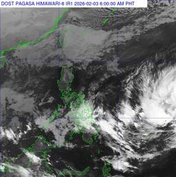
Meanwhile, in its 4:00 a.m. forecast, PAGASA said the shear line is affecting the eastern sections of Visayas and Mindanao, while the northeast monsoon is affecting Luzon.
Visayas, Caraga, Davao Region, and Misamis Oriental may experience cloudy skies with scattered rains and isolated thunderstorms due to the shear line.
Batanes and the Babuyan Islands will have cloudy skies with light rains due to the northeast monsoon.
The rest of Mindanao will have partly cloudy to cloudy skies with isolated rain showers or thunderstorms caused by localized thunderstorms.
Metro Manila and the rest of Luzon will have partly cloudy to cloudy skies with isolated light rains due to the northeast monsoon.