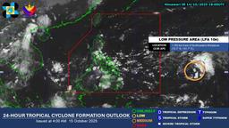
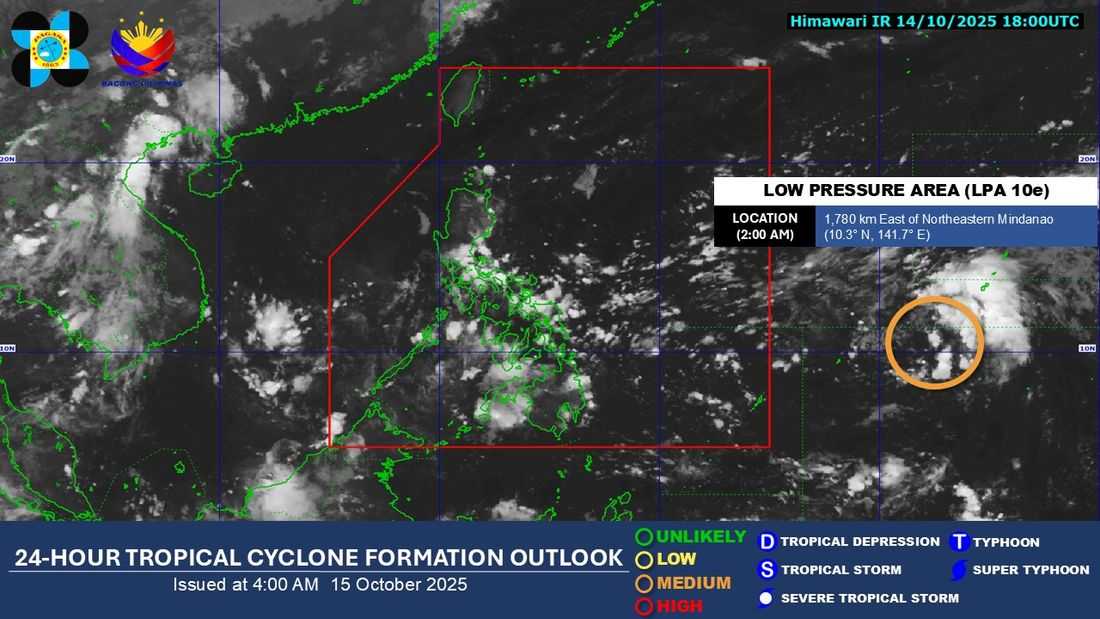
A Low Pressure Area (LPA) outside the Philippine Area of Responsibility (PAR) has a high chance of developing into a tropical cyclone within the next 24 hours, according to the Philippine Atmospheric, Geophysical and Astronomical Services Administration (PAGASA).
As of 5 a.m. Wednesday, the weather bureau said the LPA was last spotted 1,765 kilometers east of northeastern Mindanao. It may enter the PAR by Thursday, October 16, and will be named “Ramil” once it develops into a tropical depression.
Based on the current forecast track, the weather disturbance could move closer to Northern Luzon and may bring rain showers over large parts of Luzon by the weekend.
"Sa ngayon malayo pa ang Low Pressure Area natin kaya posible pa rin pong magbago ang ating forecast track" said PAGASA Weather Specialist Chenel Dominguez.
Meanwhile, rainy conditions are still expected today in Metro Manila, CALABARZON, Bicol Region, Eastern Visayas, Isabela, Aurora, Nueva Ecija, Bulacan, Marinduque, Oriental Mindoro, Romblon, Capiz, Aklan, Cebu, and Bohol due to the continuing effects of easterlies.
The rest of the country will experience generally fair weather with isolated rain showers.