
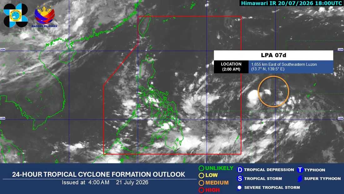
A low pressure area (LPA) being monitored outside the Philippine Area of Responsibility (PAR) has a medium chance of developing into a tropical depression within the next 24 hours, the Philippine Atmospheric, Geophysical and Astronomical Services Administration (PAGASA) said on Tuesday, July 21.
In its 5:00 a.m. weather bulletin, PAGASA weather specialist Chenel Dominguez said the LPA was estimated at 1,630 kilometers east of Southeastern Luzon.
The weather bureau said the disturbance currently has a medium probability of intensifying into a tropical depression within the next 24 hours, with the likelihood of further development expected to increase in the succeeding days.
PAGASA added that the LPA may enter the PAR by Tuesday afternoon, July 21 or early Wednesday morning, July 22.
Meanwhile, the southwest monsoon or 'habagat,' continues to affect Mindanao and the western sections of Luzon and the Visayas.
Because of the monsoon, Western Visayas, the Negros Island Region, the Zamboanga Peninsula, and the Bangsamoro Autonomous Region in Muslim Mindanao (BARMM) are expected to experience cloudy skies with scattered rains and thunderstorms, with possible flooding or landslides in areas affected by moderate to heavy rainfall.
- Ilocos Region
- Cordillera Administrative Region (CAR)
- MIMAROPA
- Batanes
- Babuyan Islands
- Zambales
- Bataan
- Cavite
- Batangas
The rest of the country will also experience partly cloudy to cloudy skies with isolated rain showers or thunderstorms, mainly due to localized thunderstorms.
PAGASA said residents in Zamboanga Peninsula, Western Visayas, the Negros Island Region, and BARMM may continue to experience scattered rains throughout Tuesday.
PAGASA warned that localized thunderstorms may still develop in the afternoon and evening, bringing brief but sometimes intense rainfall.
