
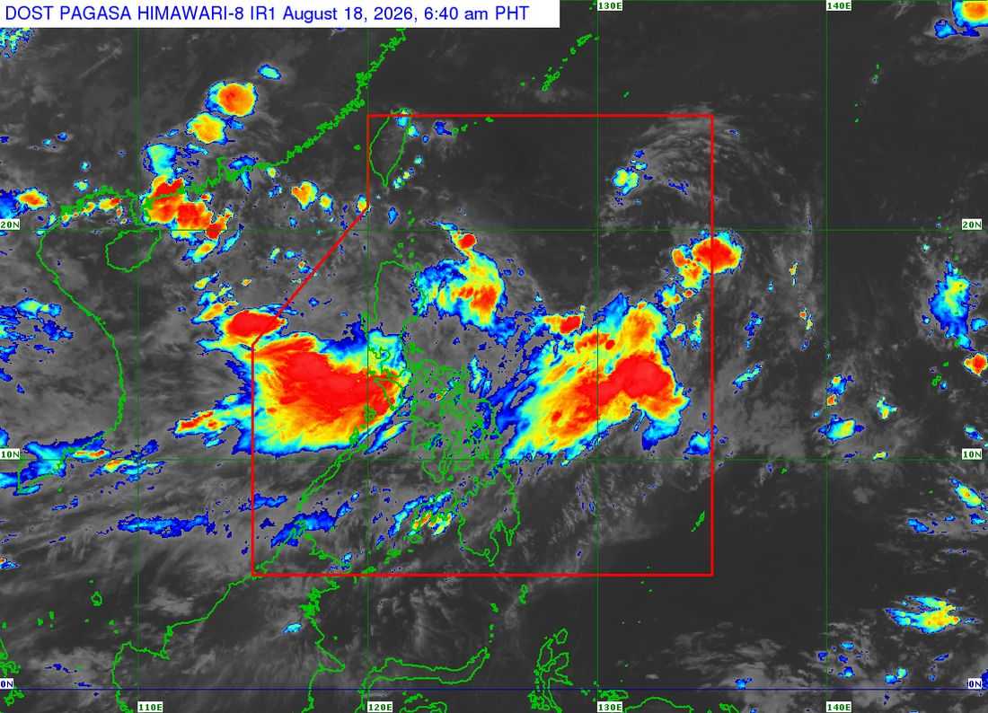
Two low pressure areas (LPAs) are being monitored by PAGASA, with one having a "high" chance of developing into a tropical depression within the next 24 hours as the southwest monsoon or Habagat continues to affect parts of Luzon and Visayas, the state weather bureau said Tuesday, August 18.
In its 5 a.m. weather bulletin, the Philippine Atmospheric, Geophysical and Astronomical Services Administration (PAGASA) said the LPA 08f inside the Philippine Area of Responsibility (PAR), was last located at 3 a.m. about 1,115 kilometers east-northeast of Northern Luzon.
Should the weather disturbance develop into a tropical depression while inside the PAR, it will be given the local name “Neneng.”
Another LPA, identified as LPA 08g, which is outside the PAR, was last located 295 kilometers west-northwest of Laoag City. PAGASA said LPA 08g has a “medium” chance of developing into a tropical depression within the next 24 hours. However, it is not expected to enter the PAR and is instead forecast to move away from the Philippine landmass.
Meanwhile, the southwest monsoon is affecting Luzon and Visayas, bringing rains to a large part of the country, with heavier rainfall expected over the western sections of Luzon and Visayas, including Metro Manila.
Monsoon rains are expected over Benguet, La Union, Pangasinan, Zambales, Bataan, Cavite, Batangas, and Occidental Mindoro.
“Kapag binanggit nga natin yung monsoon rains, ito yung mga tuloy-tuloy na mga malalakas na mga pag-ulan,” said weather specialist, Veronica Torres.
Occasional rains are forecast over Abra, Ilocos Sur, Tarlac, Pampanga, Bulacan, Nueva Ecija, Laguna, Rizal, Oriental Mindoro, and Metro Manila.
“Occasional rains naman yung pasulpot-sulpot din ng mga pagulan na posible pa rin naman itong mag-cause ng mga pagbaha at pagguho ng lupa. Kabila nga sa occasional rains din yung lugar ng Metro Manila,” she added.
PAGASA warned that the rains could still trigger flooding and landslides, particularly in areas that have already experienced prolonged rainfall in recent weeks.
In Visayas, occasional rains are expected over Antique, while the Negros Island Region and the rest of Western Visayas may experience cloudy skies with scattered rain showers, thunderstorms, and lightning.
The rest of Visayas and Mindanao will generally experience partly cloudy to cloudy skies, with localized thunderstorms possible in some areas.
PAGASA also forecast rainfall of 100 to 200 millimeters over Occidental Mindoro, Cavite, Batangas, Bataan, Zambales, Pangasinan, La Union, and Benguet.
Rainfall of 100 to 200 millimeters may likely cause flooding in urbanized and low-lying areas, particularly those near rivers, as well as landslides in highly susceptible areas.
Meanwhile, rainfall of 50 to 100 millimeters is possible over Abra, Ilocos Sur, Tarlac, Nueva Ecija, Pampanga, Bulacan, Metro Manila, Rizal, Laguna, Oriental Mindoro, and Antique.
Rainfall of 50 to 100 millimeters may cause localized flooding in urbanized and low-lying areas, particularly those near rivers, as well as landslides in highly susceptible areas.
No gale warning is currently in effect over any coastal waters in the country, although PAGASA advised caution among sea travelers in the northern and western portions of Northern Luzon and the eastern portion of Mindanao due to moderate to rough seas.
