“Life-threatening” conditions continue to prevail in the Bicol region, particularly in Camarines Norte, and loom over Aurora and Polillo Islands as Super Typhoon Uwan continues to traverse its west northwestward course, said the state weather bureau.
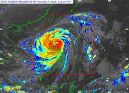
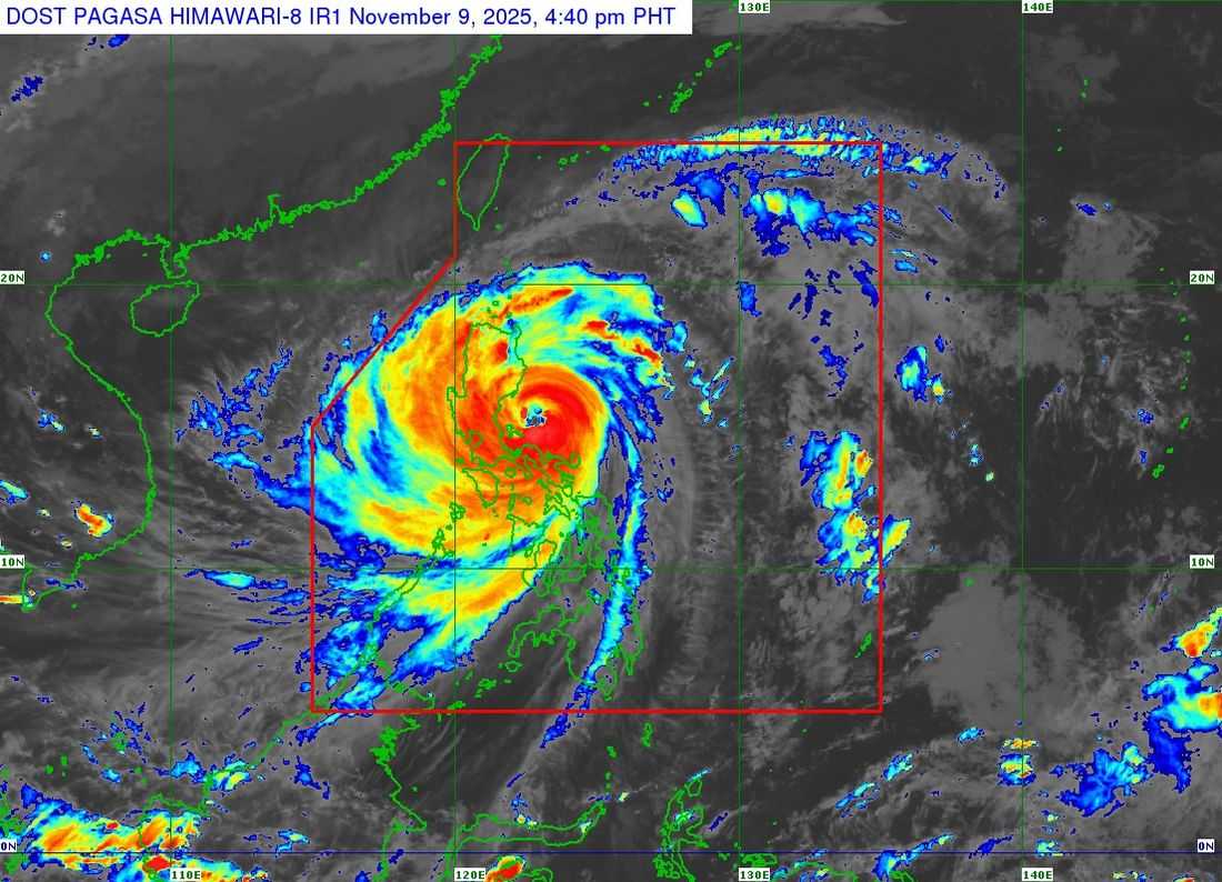
As of 5:00 p.m., the Philippine Atmospheric, Geophysical and Astronomical Services Administration (PAGASA) announced that the eye of Uwan was estimated to be 110 kilometers north of Daet, Camarines Norte, or 150 kilometers east northeast of Infanta, Quezon.
Uwan continues to carry maximum sustained winds of 185 km/hr near the center, with a gustiness of up to 230 km/hr. It is still moving west northwestward at a speed of 30 km/hr.
Tropical Cyclone Wind Signal (TCWS) No. 5, denoting typhoon-force winds at speeds of 185 km/hr or higher and an extreme threat to life and property, is in effect for the following areas:
LUZON
-
The southern portion of Quirino (Nagtipunan)
-
The southeastern portion of Nueva Vizcaya (Alfonso Castañeda, Dupax del Norte, Dupax del Sur)
-
The northeastern portion of Nueva Ecija (Bongabon, Carranglan, Pantabangan)
-
The central portion of Aurora (San Luis, Baler, Maria Aurora, Dipaculao, Dinalungan)
-
Polillo Islands
-
The northern portion of Camarines Norte (Paracale, Vinzons) including Calaguas Islands
TCWS No. 4, indicating typhoon-force winds with speeds ranging from 118 to 184 km/hr and a significant to severe potential impact, has been raised over:
LUZON
-
The southern portion of Isabela (San Agustin, Jones, Echague, Dinapigue, San Guillermo, Cordon, City of Santiago)
-
The rest of Quirino
-
The rest of Nueva Vizcaya
-
The southern portion of Mountain Province (Tadian, Bauko, Sabangan)
-
The southern portion of Ifugao (Tinoc, Asipulo, Lamut, Kiangan, Lagawe, Hingyon, Hungduan)
-
Benguet
-
The southern portion of Ilocos Sur (Sugpon, Alilem, Cervantes, City of Candon, Santa Lucia, Suyo, Sigay, Galimuyod, Tagudin, Santa Cruz, Salcedo, San Esteban, Santiago)
-
La Union
-
Pangasinan
-
The rest of Aurora
-
The rest of Nueva Ecija
-
The northernmost portion of Zambales (Santa Cruz)
-
The northeastern portion of Tarlac (Camiling, San Clemente, Paniqui, Gerona, Victoria, Pura, Ramos, Moncada, San Manuel, Anao, La Paz, City of Tarlac, Santa Ignacia)
-
The easternmost portion of Pampanga (Candaba)
-
The eastern portion of Bulacan (Doña Remedios Trinidad, San Miguel, San Ildefonso, Norzagaray, San Rafael)
-
The northern portion of Rizal (Rodriguez)
-
The northern and eastern portions of Quezon (Tagkawayan, Calauag, Guinayangan, Perez, Alabat, Quezon, Infanta, General Nakar, Real, Mauban)
-
The rest of Camarines Norte
-
The northern portion of Camarines Sur (Del Gallego, Ragay, Lupi, Cabusao, Sipocot, Libmanan, Bombon, Calabanga, Canaman, Magarao, Tinambac, Siruma, Goa, Tigaon, Pasacao, Milaor, Gainza, Naga City, Pamplona, Camaligan, San Jose, Lagonoy, Presentacion, Garchitorena, Caramoan)
-
The northern portion of Catanduanes (Caramoran, Bagamanoc, Pandan, Panganiban)
Meanwhile, TCWS No. 3, which signals storm-force winds at speeds of 89 to 117 km/hr and a moderate to significant potential impact, will be experienced in the areas listed below:
LUZON
-
The southern portion of mainland Cagayan (Tuao, Enrile, Solana, Tuguegarao City, Peñablanca, Iguig, Piat, Amulung, Santo Niño, Alcala, Rizal)
-
The rest of Isabela
-
The northwestern, central, and southern portions of Apayao (Conner, Kabugao, Calanasan)
-
Abra
-
Kalinga
-
The rest of Mountain Province
-
The rest of Ifugao
-
Ilocos Norte
-
The rest of Ilocos Sur
-
The rest of Zambales
-
Bataan
-
The rest of Tarlac
-
The rest of Pampanga
-
The rest of Bulacan
-
Metro Manila
-
Cavite
-
Batangas
-
The rest of Rizal
-
Laguna
-
The rest of Quezon
-
Marinduque
-
The rest of Camarines Sur
-
The rest of Catanduanes
-
Albay
-
Sorsogon
-
Ticao
-
Burias Islands
VISAYAS
-
The northwestern portion of Northern Samar (San Isidro, San Vicente, San Antonio, Capul, Lavezares, San Jose, Victoria, Allen, Rosario, Bobon, Catarman, Biri)
TCWS No. 2 is in effect in the following areas, which will experience gale-force winds at speeds of 62 to 88 km/hr and a minor to moderate threat to life and property:
LUZON
-
Babuyan Islands
-
The rest of mainland Cagayan
-
The rest of Apayao
-
Occidental Mindoro
-
Oriental Mindoro
-
Romblon
-
The rest of Masbate
VISAYAS
-
The rest of Northern Samar
-
The northern portion of Samar (Calbayog City, Santo Niño, Almagro, Tagapul-An, Tarangnan, San Jorge, Pagsanghan, Gandara, Santa Margarita, Matuguinao, San Jose de Buan)
-
The northern portion of Eastern Samar (Maslog, Arteche, Oras, San Policarpo, Jipapad, Dolores)
Lastly, TCWS No. 1—strong winds of 39 to 61 km/hr speeds that may bring minimal to minor impacts—has been raised over:
LUZON
-
Batanes
-
The northern portion of Palawan (Taytay, Dumaran, El Nido, Araceli, Roxas, San Vicente) including Calamian, Cuyo, and Cagayancillo Islands
VISAYAS
-
The rest of Samar
-
The rest of Eastern Samar
-
Biliran
-
Leyte
-
Southern Leyte
-
Cebu
-
Bohol
-
Siquijor
-
Negros Oriental
-
Negros Occidental
-
Guimaras
-
Iloilo
-
Capiz
-
Aklan
-
Antique
MINDANAO
-
Dinagat Islands
-
Surigao del Norte
“UWAN is forecast to move west northwestward over the next 24 hours. On the track forecast, the center of the eye of UWAN will pass close to Polillo Islands before making landfall at or near its peak intensity (e.g., as a super typhoon or an upper limit of typhoon) over the central portion of Aurora tonight or tomorrow (10 November) early morning,” PAGASA said.
After making landfall, Uwan will pass the mountainous terrain of Northern Luzon, which will cause it to weaken significantly before emerging over Lingayen Gulf or the coastal waters of Pangasinan or La Union on Monday morning. Despite weakening, it is expected to remain in the typhoon category throughout its passage over Northern Luzon.
Starting tomorrow to Tuesday (November 11), Uwan will turn northwestward to northward, heading for the Taiwan Strait as it weakens. PAGASA expects it will make landfall over western Taiwan on Thursday (November 13).