
The National Disaster Risk Reduction and Management Council (NDRRMC) has issued red and orange rainfall warnings as Typhoon "Tino" continues moving over the Philippine Sea.
Red warning (most severe): Biliran, Samar, Eastern Samar, Leyte, Southern Leyte – expect heavy rain, floods, and landslides.
Orange warning (dangerous but slightly less severe): Bohol, Cebu, Siquijor, Negros Oriental, Negros Occidental, Northern Samar – expect strong rain, possible flooding, and landslides.
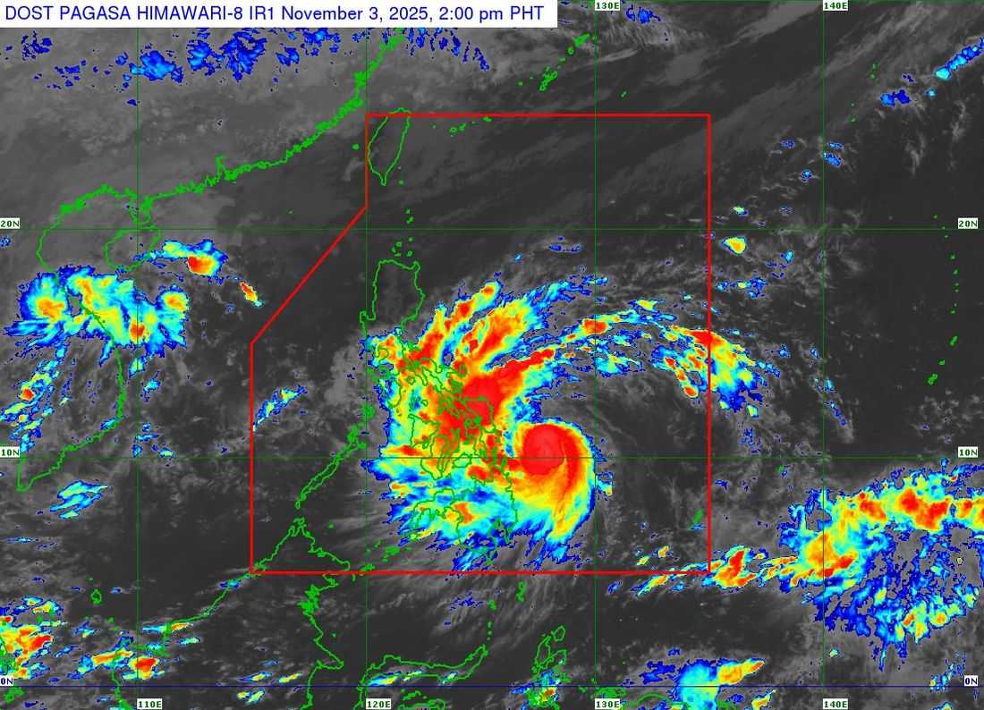
According to the 2:00 PM bulletin of the Philippine Atmospheric, Geophysical and Astronomical Services Administration (PAGASA), Typhoon "Tino" is moving generally westward and may make its initial landfall tonight or early tomorrow morning (November 4) in southern Eastern Samar, Leyte, Southern Leyte, or the Dinagat Islands.
After crossing the Visayas and northern Palawan, it is expected to emerge over the West Philippine Sea by Wednesday afternoon and exit the Philippine Area of Responsibility (PAR) by Thursday morning.
Currently forecasted with maximum winds of 150–165 km/h and higher gusts, "Tino" is expected to retain typhoon strength throughout its passage.
Rapid intensification is possible in the next 24 hours, though interaction with the country’s terrain may slightly weaken it.
The NDRRMC reminds residents to remain vigilant, follow official advisories, and take precautions against storm surges, flooding, landslides, and severe winds, even in areas outside the immediate projected path.
The typhoon’s center was last estimated 235 km east-southeast of Guiuan, Eastern Samar (10.4°N, 127.8°E) based on Doppler radar data and other meteorological sources.
Authorities urge all communities to monitor local updates and heed evacuation orders when necessary to minimize risk.