
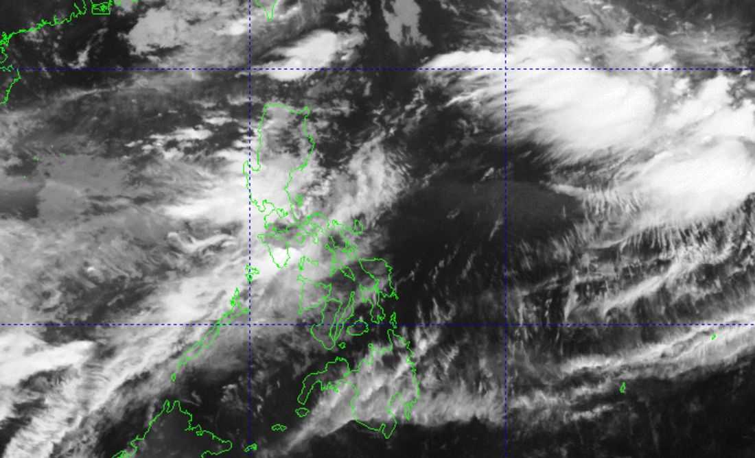
The southwest monsoon or Habagat will continue to bring rains over parts of Luzon and the western section of Visayas, according to PAGASA on Monday, August 10.
PAGASA said monsoon rains are expected over Benguet, Zambales, and Bataan, while occasional rains due to the Habagat may affect Metro Manila, the Ilocos Region, the rest of the Cordillera Administrative Region, Nueva Vizcaya, Tarlac, Nueva Ecija, Pampanga, Bulacan, Rizal, Cavite, Batangas, Oriental Mindoro, and Occidental Mindoro.
Meanwhile, Western Visayas, the rest of Cagayan Valley, the rest of CALABARZON and MIMAROPA, as well as Camarines Norte and Camarines Sur, may experience cloudy skies with scattered rains and thunderstorms caused by the southwest monsoon.
The rest of the country will generally have partly cloudy to cloudy skies with isolated rain showers or thunderstorms due to localized thunderstorms.
Heavy rainfall outlook
In its Weather Advisory No. 34 issued at 5 a.m. Monday, PAGASA warned of potentially heavy rainfall in several areas due to the continued influence of the Habagat.
For Monday, rainfall of more than 200 millimeters is possible over Benguet, while 100 to 200 millimeters may be recorded in Zambales, Bataan, and Occidental Mindoro.
Meanwhile, 50 to 100 millimeters of rain may fall over Metro Manila, Ilocos Norte, Ilocos Sur, La Union, Abra, Pangasinan, Kalinga, Mountain Province, Ifugao, Nueva Vizcaya, Tarlac, Nueva Ecija, Pampanga, Bulacan, Rizal, Cavite, Batangas, Laguna, and Oriental Mindoro.
PAGASA said rainfall may be higher in mountainous and elevated areas, while the impacts of the rains may be worsened by significant rainfall already received in some areas.
For Tuesday, 100 to 200 millimeters of rain is possible over Benguet, Zambales, Bataan, and Occidental Mindoro, while 50 to 100 millimeters may be recorded in Ilocos Sur, La Union, Pangasinan, Batangas, and Oriental Mindoro.
On Wednesday, August 12, Zambales, Bataan, and Occidental Mindoro may receive 50 to 100 millimeters of rain.
PAGASA advised concerned disaster risk reduction and management offices to take necessary measures to protect lives and property.
The agency also said its regional offices may issue Heavy Rainfall Warnings, Thunderstorm Advisories, and other severe weather information as needed.
Peilou remains outside PAR
Meanwhile, Tropical Storm Peilou (2616) remains outside the Philippine Area of Responsibility (PAR) as of 3 a.m. Monday.
The storm was located about 2,515 kilometers east of extreme Northern Luzon, with maximum sustained winds of 65 kilometers per hour near the center and gustiness of up to 80 kilometers per hour.
Peilou was moving east-southeastward at 25 kilometers per hour.
PAGASA's latest advisory did not place Peilou as the primary cause of the current rains, with the southwest monsoon remaining the dominant weather system affecting the western sections of the country.
